
 – click for General Verification Guidelines | – click for Specific Verification Guidelines
  – Uncertain/Unknown – Insufficient Data

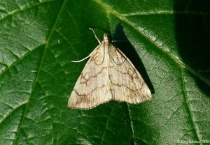
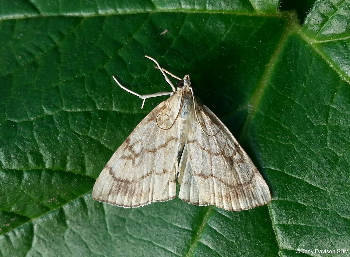
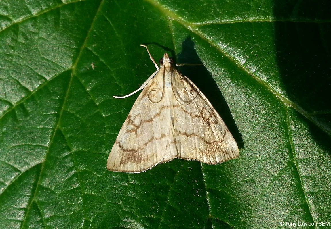
Image Gallery


Temporal Distribution Chart
Adults: (between 1997 - 2025)
Distribution Map for Evergestis pallidata
↳ from 2026+
↳ 23 from 2020 - 2025
↳ 21 from Before 2020
If the Map Layers function fails, just refresh the page and it should be OK after. Use the +- zoom on the top left, or on a tablet, use two fingers to zoom. Remember, the last layer you ticked is the one which displays the popup information - they sit on top of each other - de-select then re-select, to see the popup values.
Bedrock Geology ** indirectly affects moth distribution by influencing the type of habitat and food plants available in an area. In turn, this may affect the types of moths that can thrive, or where they can most likely be found.
NBN Atlas UK Distribution for – Evergestis pallidata
⚠️ Please wait for the map to load fully – do not click the link shown.
Note – the NBN Atlas datasets are listed in the map below and vary in their currency (uptodateness) – however,
the map does give a general indication of the moth's distribution across the UK.
Monthly Records By Year:
Evergestis pallidata
( data includes both Larvae and Adult Stages )
Monthly Counts By Year:
Evergestis pallidata
( data is based on 'Adult' stage records only )
First/Last Recorded Dates: Evergestis pallidata
Adult-only & Anything [Larvae, Pupae, Adult, Mines]
Shading shows moth presence between dates
Click the colour discs below to Select/De-select as Required
Recordings By Year: Evergestis pallidata
( All data includes both Larvae and Adult Stages )
Annual Growth Rate (AGR): Evergestis pallidata
AGR: 0.5% | Total % Change: 11.1%
Hectad (10kmx10km) Coverage: Evergestis pallidata
( data includes both Larvae and Adult Stages )
Flight Periods – Indicative –vs– Recorded Data
Evergestis pallidata
Evergestis pallidata
Flight Period chart – the grey hatched area above, which can cross one or more months, pictorially represents the best guess we have for this moth's flight periods [month/s]. The coloured lines represent the actual months seen in flight, from site observation records received between 2020-2026.
Records Behind the Map and Charts - Evergestis pallidata – 44 records available
Listed by Year - descending - scroll across to see all table columns
| Site Name | Tetrad | Date | Count | Stage | Recorder | Source | RecordKey |
|---|---|---|---|---|---|---|---|
| Bamford, Hope Valley SBE, UK | SK28B | 25/08/2025 | 1 | Adult | roger_forton | vc57_irecords_extract | iBRC44927568 |
| High Leas Farm | SK35D | 09/08/2025 | 1 | adult | Thorpe, Steve | vc57_irecords_extract | iBRC49657289 |
| upper cromford garden | SK25Y | 29/07/2025 | 1 | adult | Ashton, Clive | vc57_irecords_extract | iBRC44038696 |
| Jim Mart Nature Reserve | SK36S | 26/07/2025 | 2 | adult | Mahadevan, Nikki | vc57_irecords_extract | iBRC43885350 |
| Allestree, Derby | SK33P | 26/07/2025 | 1 | adult | Plant, Stephen | vc57_irecords_extract | iBRC43896911 |
| Old Marble Mill, Ashford in the Water | SK16Z | 23/07/2025 | 1 | adult | Steven Bell | vc57_irecords_extract | iBRC43756041 |
| Jim Mart Nature Reserve | SK36S | 23/07/2025 | 1 | adult | Mahadevan, Nikki | vc57_irecords_extract | iBRC44451326 |
| upper cromford garden | SK25Y | 10/07/2025 | 1 | adult | Ashton, Clive | vc57_irecords_extract | iBRC43285749 |
| Scalpcliffe road | SK22R | 04/07/2025 | 1 | adult | Ward, Clive | vc57_irecords_extract | iBRC44483505 |
| Jim Mart Nature Reserve | SK36S | 10/08/2024 | 2 | adult | Mahadevan, Nikki | vc57_irecords_extract | iBRC37877995 |
| Stonebroom. | SK45E | 03/08/2024 | 1 | adult | Bradley, Jonathan | vc57_irecords_extract | iBRC37733895 |
| Lower Cromford Garden | SK25Y | 23/07/2024 | 1 | adult | Ashton, Clive | vc57_irecords_extract | iBRC37305512 |
| upper cromford garden | SK25Y | 22/07/2024 | 1 | adult | Ashton, Clive | vc57_irecords_extract | iBRC37281388 |
| Norton Lees, Sheffield, UK | SK38L | 20/07/2024 | 1 | Adult | Mella, Pete | vc57_irecords_extract | iBRC37225357 |
| Derbyshire, UK | SK26I | 10/08/2023 | 1 | Adult | Orridge, Steve | vc57_irecords_extract | iBRC32481664 |
| Belper | SK34U | 12/08/2022 | 1 | adult | Evans, Dave | vc57_irecords_extract | iBRC35318167 |
| Hathersage, Derbyshire, UK | SK28F | 09/08/2022 | 1 | adult | Miles, Claire | vc57_irecords_extract | iBRC28420789 |
| Hathersage | SK28F | 11/07/2022 | 1 | adult | Kydd, Alan | vc57_irecords_extract | iBRC39061719 |
| Hathersage | SK28F | 20/08/2021 | 1 | adult | Kydd, Alan | vc57_irecords_extract | iBRC39049878 |
| Hathersage, Derbyshire, UK | SK28F | 15/08/2021 | 1 | adult | Miles, Claire | vc57_irecords_extract | iBRC29841081 |
| Hathersage, Derbyshire, UK | SK28F | 31/07/2021 | 1 | adult | Miles, Claire | vc57_irecords_extract | iBRC29836417 |
| Ninelands Road | SK28F | 06/08/2020 | 1 | adult | Blues, Clare | vc57_irecords_extract | iBRC27431449 |
| Findern, Derbyshire, DEAZ | SK33A | 30/07/2020 | 1 | adult | Brian and Jean Hallam | vc57_irecords_extract | iBRC35163413 |
| Hathersage, Derbyshire, UK | SK28F | 25/07/2019 | 1 | adult | Miles, Claire | vc57_irecords_extract | iBRC12494128 |
| Jim Mart Nature Reserve | SK36S | 14/07/2018 | 1 | adult | Mahadevan, Nikki | vc57_irecords_extract | iBRC34917351 |
| Main Street, Kings Newton | SK32Y | 26/07/2017 | 1 | Adult | Soar, Will | vc57_irecords_extract | iBRC34060732 |
| Jim Mart Nature Reserve | SK36S | 23/07/2016 | 1 | Adult | Mahadevan, Nikki | vc57_irecords_extract | iBRC34908743 |
| Main Street, Kings Newton | SK32Y | 04/08/2014 | 1 | Adult | Soar, Will | vc57_irecords_extract | iBRC34677960 |
| Millennium Meadow NR, Duffield | SK34L | 09/07/2014 | 1 | Adult | VC57 Derbyshire Recorder | vc57_danes_bc_data | LC000334001COYWU |
| Coombs Dale,Stoney Middleton | SK27H | 10/07/2010 | 1 | Adult | Barnacle, Brian | vc57_danes_bc_data | LC000334001CP5W5 |
| Leadmill, Hathersage | SK28F | 08/07/2010 | 2 | Adult | Barnacle, Brian | vc57_danes_bc_data | LC000334001CP5T7 |
| The Mays,Malthouse Lane,Froggatt | SK27N | 08/07/2010 | 1 | Adult | Barnacle, Brian | vc57_danes_bc_data | LC000334001CP5T9 |
| The Mays,Malthouse Lane,Froggatt | SK27N | 10/08/2009 | 2 | Adult | Barnacle, Brian | vc57_danes_bc_data | LC000334001CP04D |
| The Hollies,Station Rd,Darley Dale | SK26R | 12/07/2009 | 1 | Adult | Roddis, Simon | vc57_danes_bc_data | LC000334001COWTJ |
| Robin Wood (central area) | SK32M | 04/08/2008 | 1 | Adult | Dave Budworth;P. Patrick;W. Soar | vc57_danes_bc_data | LC000334001CP4I9 |
| The Mays,Malthouse Lane,Froggatt | SK27N | 09/08/2007 | 1 | Adult | Barnacle, Brian | vc57_danes_bc_data | LC000334001COZU8 |
| The Mays,Malthouse Lane,Froggatt | SK27N | 05/08/2007 | 1 | Adult | Barnacle, Brian | vc57_danes_bc_data | LC000334001COWEB |
| Calke Park Ridge from Fisherman's Car Park | SK32R | 31/07/2007 | 5 | adult | Finch, Graham Leonard | vc57_irecords_extract | iBRC35105856 |
| The Mays,Malthouse Lane,Froggatt | SK27N | 15/08/2005 | 2 | Adult | Barnacle, Brian | vc57_danes_bc_data | LC000334001CP2V2 |
| The Mays,Malthouse Lane,Froggatt | SK27N | 14/08/2005 | 1 | Adult | Barnacle, Brian | vc57_danes_bc_data | LC000334001CP2UV |
| Main Street, Kings Newton | SK32Y | 27/07/2004 | 1 | Adult | Soar, Will | vc57_irecords_extract | iBRC34677959 |
| Main St,Kings Newton,Melbourne | SK32Y | 27/07/2004 | 1 | Adult | Soar, Will | vc57_danes_bc_data | LC000334001COZ63 |
| Calke Park (Betty's Pool),Ticknall | SK32R | 22/07/1997 | 2 | Adult | VC57 Derbyshire Recorder | vc57_danes_bc_data | LC000334001COQXK |
| Calke Park (Betty's Pool),Ticknall | SK32R | 12/07/1997 | 1 | Adult | VC57 Derbyshire Recorder | vc57_danes_bc_data | LC000334001COQXE |