
 – click for Adult Macro Verification Guidelines
 – Generally Common / Widespread
 – Day-flying
Forewing: 17-20mm
Blue-coded] moths is not displayed/updated in this tab. However, all verified records for this moth are listed in the RECORDS tab below.
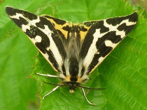
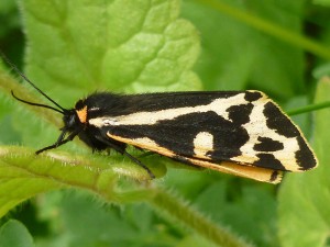


Image Gallery
No gallery images found for this moth.
Temporal Distribution Chart
Adults: (between 1918 - 2026) | Immatures: (between 1957 - 2026)
Distribution Map for Parasemia plantaginis
↳ 6 from 2026+
↳ 36 from 2020 - 2025
↳ 135 from Before 2020
If the Map Layers function fails, just refresh the page and it should be OK after. Use the +- zoom on the top left, or on a tablet, use two fingers to zoom. Remember, the last layer you ticked is the one which displays the popup information - they sit on top of each other - de-select then re-select, to see the popup values.
Bedrock Geology ** indirectly affects moth distribution by influencing the type of habitat and food plants available in an area. In turn, this may affect the types of moths that can thrive, or where they can most likely be found.
NBN Atlas UK Distribution for – Parasemia plantaginis
⚠️ Please wait for the map to load fully – do not click the link shown.
Note – the NBN Atlas datasets are listed in the map below and vary in their currency (uptodateness) – however,
the map does give a general indication of the moth's distribution across the UK.
Monthly Records By Year:
Parasemia plantaginis
( data includes both Larvae and Adult Stages )
Monthly Counts By Year:
Parasemia plantaginis
( data is based on 'Adult' stage records only )
First/Last Recorded Dates: Parasemia plantaginis
Adult-only & Anything [Larvae, Pupae, Adult, Mines]
Shading shows moth presence between dates
Click the colour discs below to Select/De-select as Required
Recordings By Year: Parasemia plantaginis
( All data includes both Larvae and Adult Stages )
Annual Growth Rate (AGR): Parasemia plantaginis
AGR: 0.7% | Total % Change: 20%
Hectad (10kmx10km) Coverage: Parasemia plantaginis
( data includes both Larvae and Adult Stages )
Flight Periods – Indicative –vs– Recorded Data
Parasemia plantaginis
Parasemia plantaginis
Flight Period chart – the grey hatched area above, which can cross one or more months, pictorially represents the best guess we have for this moth's flight periods [month/s]. The coloured lines represent the actual months seen in flight, from site observation records received between 2020-2026.
Records Behind the Map and Charts - Parasemia plantaginis – 177 records available
Listed by Year - descending - scroll across to see all table columns
| Site Name | Tetrad | Date | Count | Stage | Recorder | Source | RecordKey |
|---|---|---|---|---|---|---|---|
| upper cromford garden | SK25Y | 07/06/2026 | 1 | adult | Ashton, Clive | vc57_irecords_extract | iBRC53246957 |
| Upper Padley, Derbyshire | SK27P | 05/06/2026 | 1 | adult | Chadwick-Pugh, Sally | vc57_irecords_extract | iBRC53144592 |
| rose end meadows | SK25Y | 31/05/2026 | 2 | adult | Ashton, Clive | vc57_irecords_extract | iBRC52927473 |
| rose end meadows | SK25Y | 28/05/2026 | 1 | adult | Ashton, Clive | vc57_irecords_extract | iBRC52740153 |
| Parsley Hay, Derbyshire | SK16L | 27/05/2026 | 1 | adult | Harper, Shane | vc57_irecords_extract | iBRC52742008 |
| rose end meadows | SK25Y | 12/05/2026 | 1 | larva | Ashton, Clive | vc57_irecords_extract | iBRC52177323 |
| Derwent Edge | SK19Q | 28/06/2025 | 1 | Adult | Atkinson, Ray | vc57_irecords_extract | iBRC42786227 |
| Hope Brink, Win Hill | SK18T | 06/06/2025 | 1 | Adult | Tom Gillot | vc57_irecords_extract | iBRC42090003 |
| Tideswell | SK17L | 03/06/2025 | 1 | Adult | Bermingham, Katie | vc57_irecords_extract | iBRC42064639 |
| upper cromford garden | SK25Y | 31/05/2025 | 1 | Adult | Ashton, Clive | vc57_irecords_extract | iBRC41994395 |
| Middleton by Wirksworth | SK25T | 25/05/2025 | 1 | Adult | Dinsdale, Kay | vc57_irecords_extract | iBRC41882173 |
| High Peak Quarry Longcliffe - S | SK25H | 21/05/2025 | 1 | Adult | Bridget Edwards | vc57_irecords_extract | iBRC41829398 |
| Deep Dale | SK17Q | 19/05/2025 | 1 | Adult | Harvey, Martin C. | vc57_irecords_extract | iBRC41755723 |
| Lightwood Reserve, Buxton | SK07M | 18/05/2025 | 1 | Adult | Taylor, Sue | vc57_irecords_extract | iBRC42019611 |
| Cromford | SK25S | 18/05/2025 | 1 | Adult | Oakley, Lara | vc57_irecords_extract | iBRC41655382 |
| Chee Dale: Station Quarry | SK17G | 17/05/2025 | 4 | Adult | Harvey, Martin C. | vc57_irecords_extract | iBRC41710524 |
| CheeDale Quarry Reserve | SK17G | 17/05/2025 | 3 | Adult | Taylor, Sue | vc57_irecords_extract | iBRC41864957 |
| Miller's Dale Quarry | SK17L | 17/05/2025 | 1 | Adult | Hewitt, Jane | vc57_irecords_extract | iBRC48232879 |
| Burbage Rocks | SK28R | 17/05/2025 | 1 | Larva | glanville | vc57_irecords_extract | iBRC42384906 |
| Kinder | SK18D | 16/05/2025 | 1 | Adult | Peter Brash | vc57_irecords_extract | iBRC41632471 |
| rose end meadows | SK25Y | 10/05/2025 | 1 | Adult | Ashton, Clive | vc57_irecords_extract | iBRC41483499 |
| DWT Hoe Grange Quarry | SK25I | 25/06/2024 | 2 | Adult | Evans, Dave | vc57_irecords_extract | iBRC36646641 |
| Hoe Grange Quarry - S | SK25I | 22/06/2024 | 1 | Adult | Ray Walker | vc57_irecords_extract | iBRC36624213 |
| Middleton Moor | SK25S | 12/06/2024 | 1 | Adult | Dinsdale, Kay | vc57_irecords_extract | iBRC36418321 |
| Middleton by Wirksworth | SK25S | 03/06/2024 | 1 | Adult | Dinsdale, Kay | vc57_irecords_extract | iBRC36247973 |
| Blackamoor | SK27Z | 21/05/2024 | 1 | pupa | Stirrups , Jessica | vc57_irecords_extract | iBRC36057534 |
| Longstone Edge | SK27B | 09/06/2023 | 1 | Adult | BISSITT, ANDREW | vc57_irecords_extract | iBRC31137363 |
| Hartington Meadows | SK16K | 04/06/2023 | 1 | Adult | Higginson-Tranter, Dave | vc57_irecords_extract | iBRC30671188 |
| Longstone Cliff | SK17W | 03/06/2023 | 2 | Adult | Hartley, Alan | vc57_irecords_extract | iBRC30673754 |
| Deep Dale | SK16U | 16/05/2023 | 1 | larva | Stretton, Tamasine | vc57_irecords_extract | iBRC30352589 |
| Big Moor and Barbrook | SK27T | 27/07/2022 | 1 | larva | Watchorn, Andrew | vc57_irecords_extract | iBRC27516659 |
| Woodhead trail | SK09Z | 21/06/2022 | 1 | Adult | Heintzen, Christian | vc57_irecords_extract | iBRC36769205 |
| Hopton Quarry | SK25S | 04/06/2022 | 4 | Adult | Higginson-Tranter, Dave | vc57_irecords_extract | iBRC25641177 |
| Haydale, Derbyshire | SK17R | 02/06/2022 | 1 | Adult | Mackey, Joanna | vc57_irecords_extract | iBRC25611081 |
| Broadlea Farm | SK07N | 17/06/2021 | 1 | Adult | Groom, Jonathan | vc57_irecords_extract | iBRC20766000 |
| Ladycroft Ave, Buxton | SK07S | 13/06/2021 | 1 | Adult | Orridge, Steve | vc57_irecords_extract | iBRC35092655 |
| Howden Moor | SK19V | 02/05/2021 | 1 | Larva | Alex | vc57_irecords_extract | iBRC42384847 |
| Blackwell Mill, Monsal Trail | SK17B | 20/04/2021 | 1 | Larva | White, Ian M | vc57_irecords_extract | iBRC29312535 |
| Coombs Dale, Calver | SK27C | 22/06/2020 | 1 | Adult | Watchorn, Andrew | vc57_irecords_extract | iBRC14522351 |
| Hern Clough | SK09X | 20/06/2020 | 1 | Adult | Whiteley, Derek | vc57_irecords_extract | iBRC15197571 |
| Milldale, Alstonefield | SK15H | 30/05/2020 | 1 | adult | SOUTHAM, Mr G. | Danes_2019-2021 | 721 |
| Hay Dale | SK17I | 27/05/2020 | 1 | Adult | Marriott, Antony | vc57_irecords_extract | iBRC13997316 |
| Lightwood, Buxton | SK07M | 03/07/2019 | 1 | Adult | Orridge, Steve | vc57_irecords_extract | iBRC35097778 |
| Lightwood, Buxton | SK07M | 21/06/2019 | 1 | Adult | Orridge, Steve | vc57_irecords_extract | iBRC35097774 |
| Lightwood, Buxton | SK07M | 09/06/2019 | 1 | Adult | Orridge, Steve | vc57_irecords_extract | iBRC35097761 |
| Derbyshire, UK | SK25S | 09/06/2019 | 1 | Adult | Moores, Stephen | vc57_irecords_extract | iBRC10443637 |
| Hartington Meadows, Hartington | SK16K | 06/06/2019 | 1 | adult | PEARSON, Mr V. | Danes_2019-2021 | 1587 |
| Kirk Dale, Sheldon / Ashford-in-the Water | SK16Z | 05/06/2019 | 3 | Adult | Alder, Jim | vc57_irecords_extract | iBRC10381701 |
| Lightwood, Buxton | SK07M | 04/06/2019 | 1 | Adult | Orridge, Steve | vc57_irecords_extract | iBRC35097758 |
| Starkholmes | SK35E | 02/06/2019 | 1 | Adult | Buckler, Matthew | vc57_irecords_extract | iBRC13275442 |
| Cunning Dale | SK07R | 23/04/2019 | 1 | larva | Orridge, Steve | vc57_irecords_extract | iBRC35096581 |
| Clough Wood (Darley Bridge) - S | SK26K | 26/07/2018 | 1 | Adult | Ragg, Chris/Sheila | vc57_irecords_extract | iBRC7426884 |
| Clough Wood (Darley Bridge) - S | SK26K | 18/06/2018 | 1 | Adult | Ragg, Chris/Sheila | vc57_irecords_extract | iBRC7071930 |
| Colborne Moor NT | SK08W | 13/06/2018 | 1 | Adult | Whiteley, Derek | vc57_irecords_extract | iBRC10060930 |
| Torside Clough | SK09T | 07/06/2018 | 1 | Adult | Whiteley, Derek | vc57_irecords_extract | iBRC7796825 |
| Coombs Dale | SK27H | 07/06/2018 | 1 | Adult | Soar, Will | vc57_irecords_extract | iBRC34059746 |
| Derbyshire, UK | SK25U | 03/06/2018 | 1 | Adult | Moores, Stephen | vc57_irecords_extract | iBRC9977621 |
| Matlock (site not precise) | SK36A | 01/06/2018 | 1 | Adult | J. Douglas | vc57_danes_bc_data | LC000334001WPIMZ |
| National Stone Centre, Middleton by Wirksworth | SK25X | 31/05/2018 | 1 | Adult | Bryce, Marion | vc57_irecords_extract | iBRC6861304 |
| Moss Rake West | SK17J | 29/05/2018 | 1 | Adult | Whiteley, Derek | vc57_irecords_extract | iBRC7796826 |
| Middleton Top (old quarry), Wirksworth | SK25S | 01/06/2017 | 1 | Adult | Dave Budworth;P. Gilbert | vc57_danes_bc_data | LC000334001WQJRP |
| Hartington (station quarry) | SK16K | 11/06/2016 | 1 | Adult | S. Bell | vc57_danes_bc_data | LC000334001WQJPD |
| The Shimmers Cressbrook | SK17R | 06/06/2016 | 1 | Adult | Whiteley, Derek | vc57_irecords_extract | iBRC3276771 |
| Lathkill Dale | SK16S | 05/06/2016 | 4 | Adult | Van Toller, Simon | vc57_irecords_extract | iBRC30100591 |
| Longcliffe, Derbyshire | SK25I | 19/05/2016 | 2 | Adult | Plant, Stephen | vc57_irecords_extract | iBRC3170019 |
| Barber Booth | SK18C | 09/10/2015 | 1 | Larva | Whiteley, Derek | vc57_irecords_extract | iBRC3039294 |
| Burbage Moor | SK28K | 27/06/2015 | 1 | Adult | Whiteley, Derek | vc57_irecords_extract | iBRC3039311 |
| Burbage Moor, Hathersage | SK28K | 27/06/2015 | 1 | Adult | D.E. Whiteley | vc57_danes_bc_data | LC000334001WPKP3 |
| Black Plantation Longstone | SK17W | 05/06/2015 | 1 | Adult | Whiteley, Derek | vc57_irecords_extract | iBRC3039305 |
| nr Calver | SK27H | 13/06/2014 | 12 | Adult | VC57 Derbyshire Recorder | vc57_danes_bc_data | LC000334001OLECZ |
| Lathkill Dale | SK16S | 31/05/2014 | 1 | Adult | Van Toller, Simon | vc57_irecords_extract | iBRC30100526 |
| Coombs Dale, Calver | SK27C | 28/04/2014 | 1 | Larva | Watchorn, Andrew | vc57_irecords_extract | iBRC2874550 |
| Burbage Moor | SK28Q | 08/07/2013 | 1 | Adult | Whiteley, Derek | vc57_irecords_extract | iBRC3039315 |
| Chee Dale, Tideswell | SK17G | 27/06/2013 | 2 | Adult | D. Mcgeever | vc57_danes_bc_data | LC000334001OKAS6 |
| Burbage Moor | SK28R | 02/07/2012 | 1 | Adult | Whiteley, Derek | vc57_irecords_extract | iBRC3039316 |
| Burbage Moor, Dore, Sheffield | SK28R | 02/07/2012 | 1 | Adult | D. Whiteley | vc57_danes_bc_data | LC000334001OL6V6 |
| Hobs House, Monsal Dale, Little Longstone | SK17Q | 20/06/2012 | 5 | Adult | R.H. Dunn | vc57_danes_bc_data | LC000334001OL6E4 |
| Longstone Edge,Great Longstone | SK17W | 30/05/2012 | 2 | Adult | VC57 Derbyshire Recorder | vc57_danes_bc_data | LC000334001OJU9Z |
| Longstone Edge, Great Longstone | SK17W | 30/05/2012 | 2 | Adult | A. Seymour | vc57_danes_bc_data | LC000334001WOTS7 |
| Woodhead Pass (Salters Bridge), Woodhead | SK19J | 04/07/2011 | 1 | Adult | R. Foster | vc57_danes_bc_data | LC000334001OL1JH |
| Woodhead Pass (Salters Bridge), Woodhead | SK19J | 04/07/2011 | 1 | Adult | R. Foster | vc57_danes_bc_data | LC000334001WOW5T |
| Lightwood Resr,Buxton | SK07M | 24/06/2011 | 4 | Adult | Orridge, Steve | vc57_danes_bc_data | LC000334001OL0US |
| Grindslow Knoll,Edale | SK18D | 19/06/2011 | 2 | Adult | D. Morton | vc57_danes_bc_data | LC000334001OJRXR |
| Grindslow Knoll, Edale | SK18D | 19/06/2011 | 3 | Adult | D. Morton | vc57_danes_bc_data | LC000334001WPN9V |
| Longcliffe (High Peak Quarry) | SK25H | 11/06/2011 | 3 | Adult | A. Butler | vc57_danes_bc_data | LC000334001OL0D0 |
| Longstone Edge,Great Longstone | SK17W | 09/06/2011 | 1 | Adult | Barnacle, Brian | vc57_danes_bc_data | LC000334001OL0BC |
| Longstone Edge, Great Longstone | SK17W | 09/06/2011 | 1 | Adult | B. Barnacle;K. Barnacle | vc57_danes_bc_data | LC000334001WPN7A |
| Monsal Trail Upperdale | SK17R | 05/06/2011 | 1 | Adult | Whiteley, Derek | vc57_irecords_extract | iBRC3039301 |
| Ladycroft Ave,Buxton | SK07S | 04/06/2011 | 1 | Adult | Orridge, Steve | vc57_danes_bc_data | LC000334001OK651 |
| Ladycroft Ave, Buxton | SK07S | 04/06/2011 | 1 | Adult | Orridge, Steve | vc57_danes_bc_data | LC000334001WPLJD |
| Biggin Dale, nr Hartington | SK15P | 04/06/2011 | 1 | Adult | David Grundy | vc57_danes_bc_data | LC000334001OK654 |
| Slagmill Plantation,Beeley Moor | SK36E | 02/06/2011 | 1 | Adult | D.A. Clarke | vc57_danes_bc_data | LC000334001OL037 |
| Black Rocks,Cromford | SK25X | 24/05/2011 | 2 | Adult | K.R. Huston | vc57_danes_bc_data | LC000334001OK5YC |
| Black Rocks (spoil heaps),Cromford | SK25X | 23/05/2011 | 1 | Adult | K.R. Huston | vc57_danes_bc_data | LC000334001OKZRF |
| Black Rocks,Cromford | SK25X | 23/05/2011 | 1 | Adult | K.R. Huston | vc57_danes_bc_data | LC000334001OKZRG |
| Big Moor | SK27S | 09/05/2011 | 1 | Adult | Whiteley, Derek | vc57_irecords_extract | iBRC3039317 |
| Big Moor,Froggatt | SK27S | 09/05/2011 | 1 | Adult | D. Whiteley | vc57_danes_bc_data | LC000334001OKZHF |
| Slippery Stones (Yorks) | SK19S | 17/06/2010 | 1 | Adult | Whiteley, Derek | vc57_irecords_extract | iBRC3039298 |
| Slippery Stones (Derbys) | SK19S | 17/06/2010 | 1 | Adult | Whiteley, Derek | vc57_irecords_extract | iBRC3039299 |
| Slippery Stones,Upper Derwent | SK19S | 17/06/2010 | 1 | Adult | D. Whiteley | vc57_danes_bc_data | LC000334001OJOG7 |
| Harpur Hill, Buxton | SK07Q | 16/06/2010 | 1 | Adult | K.R. Huston | vc57_danes_bc_data | LC000334001OKDCF |
| Longstone Edge,Great Longstone | SK27B | 12/06/2010 | 3 | Adult | N.J. Ward | vc57_danes_bc_data | LC000334001OKSOQ |
| Hopton Wood Quarry,Cromford | SK25S | 05/06/2010 | 1 | Adult | Bryce, Marion | vc57_danes_bc_data | LC000334001OKS8L |
| Beeley Moor (Slagmill Plantation) | SK36E | 03/06/2010 | 1 | Adult | D.A. Clarke | vc57_danes_bc_data | LC000334001OKS24 |
| Longstone Edge,Baslow | SK27B | 12/06/2009 | 2 | Adult | D.A. Clarke | vc57_danes_bc_data | LC000334001OJLSC |
| Longstone Edge | SK27B | 02/06/2009 | 1 | Adult | Whiteley, Derek | vc57_irecords_extract | iBRC3039310 |
| Longstone Edge,Great Longstone | SK27B | 02/06/2009 | 1 | Adult | D. Whiteley | vc57_danes_bc_data | LC000334001OJLP9 |
| Longstone Edge,Great Longstone (site not precise) | SK27B | 15/06/2008 | 1 | Adult | M.E. Dawson;R. Woodward | vc57_danes_bc_data | LC000334001OKJYC |
| Longstone Edge | SK27B | 10/06/2008 | 1 | Adult | Whiteley, Derek | vc57_irecords_extract | iBRC3039309 |
| Longstone Edge,Great Longstone (site not precise) | SK27B | 31/05/2008 | 21 | Adult | D.A. Clarke | vc57_danes_bc_data | LC000334001OJZN2 |
| Longstone Edge,Great Longstone (site not precise) | SK27B | 29/05/2008 | 3 | Adult | R.A. Frost | vc57_danes_bc_data | LC000334001OKJMH |
| Upper Dale, Little Longstone | SK17R | 03/06/2007 | 12 | Adult | D.A. Clarke | vc57_danes_bc_data | LC000334001OJIAZ |
| Upper Dale, Little Longstone | SK17R | 03/06/2007 | 12 | Adult | D.A. Clarke | vc57_danes_bc_data | LC000334001WQEHK |
| Black Plantation Longstone | SK17W | 10/05/2007 | 1 | Adult | Whiteley, Derek | vc57_irecords_extract | iBRC3039304 |
| Black Plantation,Great Longstone | SK17W | 10/05/2007 | 1 | Adult | D. Whiteley | vc57_danes_bc_data | LC000334001OJHA0 |
| Upperdale (Monsal Trail),Little Longstone | SK17R | 16/06/2006 | 2 | Adult | M. Richardson | vc57_danes_bc_data | LC000334001OJCAK |
| Longstone Edge | SK27B | 08/06/2006 | 1 | Adult | Whiteley, Derek | vc57_irecords_extract | iBRC3039308 |
| Longstone Edge,Great Longstone | SK27B | 08/06/2006 | 1 | Adult | D. Whiteley | vc57_danes_bc_data | LC000334001OI7B2 |
| Longstone Edge | SK27B | 07/06/2006 | 1 | Adult | Whiteley, Derek | vc57_irecords_extract | iBRC3039307 |
| Longstone Edge,Great Longstone | SK27B | 07/06/2006 | 50 | Adult | D. Whiteley | vc57_danes_bc_data | LC000334001OJBWL |
| Beeley Moor, Beeley | SK26Y | 31/05/2004 | 7 | Larvae | B.L. Statham | vc57_danes_bc_data | LC000334001OI56X |
| Beeley Moor, Beeley | SK26Y | 31/05/2004 | 7 | Larvae | B.L. Statham | vc57_danes_bc_data | LC000334001WPH6D |
| Clough Wood/Darley Bridge | SK26Q | 01/06/2003 | 1 | Adult | Roddis, Simon | vc57_danes_bc_data | LC000334001OJ3AU |
| Bleaklow (Barrow Stones) | SK19I | 07/07/2001 | 1 | Adult | R.A. Frost | vc57_danes_bc_data | LC000334001OI3Y7 |
| Blacka Moor | SK28Q | 07/07/2000 | 1 | Adult | Whiteley, Derek | vc57_irecords_extract | iBRC3039318 |
| Cressbrook Mill | SK17R | 12/02/2000 | 1 | Larva | Whiteley, Derek | vc57_irecords_extract | iBRC3039300 |
| Cressbrook Mill, Little Longstone | SK17R | 12/02/2000 | 1 | Larvae | D. Whiteley | vc57_danes_bc_data | LC000334001OJ1PS |
| Long Dale | SK16V | 21/06/1999 | 1 | Adult | Whiteley, Derek | vc57_irecords_extract | iBRC3039303 |
| Long Dale, Pikehall | SK16V | 21/06/1999 | 1 | Adult | D. Whiteley | vc57_danes_bc_data | LC000334001OHO1X |
| Long Dale, Pikehall | SK16V | 21/06/1999 | 1 | Adult | D.E. Whiteley | vc57_danes_bc_data | LC000334001WPGXA |
| Hopton Quarry,Wirksworth | SK25S | 25/06/1998 | 1 | Adult | VC57 Derbyshire Recorder | vc57_danes_bc_data | LC000334001OIBRU |
| Hopton Quarry, Wirksworth | SK25S | 25/06/1998 | 1 | Adult | A.O. Aitken | vc57_danes_bc_data | LC000334001WP5F5 |
| Abbey Brook | SK19V | 13/07/1996 | 1 | Adult | Whiteley, Derek | vc57_irecords_extract | iBRC3039306 |
| Abbey Brook, Ladybower Res | SK19V | 13/07/1996 | 1 | Adult | D. Whiteley | vc57_danes_bc_data | LC000334001OI2N3 |
| Cunning Dale | SK07W | 07/07/1996 | 1 | Adult | Whiteley, Derek | vc57_irecords_extract | iBRC3039292 |
| Cunning Dale, Buxton | SK07W | 07/07/1996 | 1 | Adult | D. Whiteley | vc57_danes_bc_data | LC000334001OHN56 |
| Coombs Dale, Stoney Middleton (site not precise) | SK27H | 24/06/1995 | 1 | Adult | VC57 Derbyshire Recorder | vc57_danes_bc_data | LC000334001OHMP9 |
| Litton Frith Wood & Meadow | SK17R | 18/06/1995 | 1 | Adult | Whiteley, Derek | vc57_irecords_extract | iBRC3039302 |
| Litton (Frith Wood & Meadow), Little Longstone | SK17R | 18/06/1995 | 1 | Adult | D. Whiteley | vc57_danes_bc_data | LC000334001OIYS0 |
| Litton (Frith Wood & Meadow), Little Longstone | SK17R | 18/06/1995 | 1 | Adult | D.E. Whiteley | vc57_danes_bc_data | LC000334001WPXGY |
| Ashop Valley | SK19A | 20/06/1993 | 1 | Adult | Whiteley, Derek | vc57_irecords_extract | iBRC3039293 |
| Ashop Valley, Glossop | SK19A | 20/06/1993 | 1 | Adult | D. Whiteley | vc57_danes_bc_data | LC000334001OIX42 |
| Cunning Dale, Buxton (site not precise) | SK07W | 13/06/1993 | 1 | Adult | R.A. Frost | vc57_danes_bc_data | LC000334001OIX1J |
| Middleton Moor, Wirksworth (site not precise) | SK25S | 13/06/1993 | 1 | Adult | R.A. Frost | vc57_danes_bc_data | LC000334001OIX1K |
| Slippery Stones (Derbys) | SK19S | 20/06/1992 | 1 | Adult | Whiteley, Derek | vc57_irecords_extract | iBRC3039297 |
| Derwent Valley (Slippery Stones) | SK19S | 20/06/1992 | 1 | Adult | D. Whiteley | vc57_danes_bc_data | LC000334001OI1EH |
| Slippery Stones (Yorks) | SK19S | 13/06/1992 | 1 | Adult | Whiteley, Derek | vc57_irecords_extract | iBRC3039296 |
| Coombs Dale,Stoney Middleton | SK27H | 01/01/1992 | 1 | Adult | [VC57 Recorder] | vc57_danes_bc_data | LC000334001TAG9K |
| Johnnygate, Barlow, Chesterfield | SK37C | 09/07/1988 | 1 | Adult | VC57 Derbyshire Recorder | vc57_danes_bc_data | LC000334001OIEE0 |
| Johnnygate, Barlow, Chesterfield | SK37C | 09/07/1988 | 1 | Adult | R.T. Doncaster | vc57_danes_bc_data | LC000334001WOQAS |
| Lower Alport | SK19F | 02/07/1988 | 1 | Adult | Whiteley, Derek | vc57_irecords_extract | iBRC5990952 |
| Rowsley Sidings, Rowsley | SK26S | 01/06/1982 | 1 | Adult | VC57 Derbyshire Recorder | vc57_danes_bc_data | LC000334001OHYIP |
| Abbeydale (railway embankment), Sheffield | SK38F | 29/07/1977 | 6 | Adult | D.A. Clarke | vc57_danes_bc_data | LC000334001OIKKF |
| Lathkill Dale (site not precise), Bakewell | SK16S | 24/04/1976 | 3 | Larvae | VC57 Derbyshire Recorder | vc57_danes_bc_data | LC000334001OHFMH |
| Wragg's Quarry, Beeley Moor | SK26Y | 06/04/1971 | 1 | Larvae | VC57 Derbyshire Recorder | vc57_danes_bc_data | LC000334001OIDQ3 |
| Wragg's Quarry, Beeley Moor, Beeley | SK26Y | 06/04/1971 | 1 | Larvae | H. Trollope | vc57_danes_bc_data | LC000334001WQ9X8 |
| Nimblejack (quarry), Via Gellia, Cromford (site not precise) | SK25T | 13/06/1970 | 1 | Larvae | VC57 Derbyshire Recorder | vc57_danes_bc_data | LC000334001OIHSP |
| Dovedale (just south of Milldale) | SK15M | 22/06/1969 | 1 | Adult | F. Harrison | vc57_danes_bc_data | LC000334001OHENG |
| Lathkill Dale (site not precise), Youlgreave | SK26D | 03/05/1969 | 50 | Larvae | VC57 Derbyshire Recorder | vc57_danes_bc_data | LC000334001OIHMF |
| Lathkill Dale (site not precise), Youlgreave | SK26D | 27/04/1968 | 6 | Larvae | VC57 Derbyshire Recorder | vc57_danes_bc_data | LC000334001OHEK9 |
| Lathkill Dale (site not precise) | SK16S | 18/06/1967 | 1 | Adult | VC57 Derbyshire Recorder | vc57_danes_bc_data | LC000334001OIHG4 |
| Lathkill Dale (site not precise) | SK16S | 14/06/1967 | 22 | Adult | VC57 Derbyshire Recorder | vc57_danes_bc_data | LC000334001OHEK8 |
| Slagmill Plantation,Beeley Moor | SK36E | 26/06/1966 | 2 | Adult | VC57 Derbyshire Recorder | vc57_danes_bc_data | LC000334001OIHED |
| Lathkill Dale (site not precise), Youlgreave | SK26D | 22/06/1966 | 1 | Adult | VC57 Derbyshire Recorder | vc57_danes_bc_data | LC000334001OIHE6 |
| Lathkill Dale (site not precise), Youlgreave | SK26D | 19/06/1966 | 2 | Adult | VC57 Derbyshire Recorder | vc57_danes_bc_data | LC000334001OIHDZ |
| Hollingworth Clough, Hayfield (site not precise) | SK08P | 24/05/1964 | 1 | Larvae | VC57 Derbyshire Recorder | vc57_danes_bc_data | LC000334001OIH6D |
| Ronksley Moor, Bleaklow (site not precise) | SK09Y | 09/07/1961 | 1 | Adult | F. Harrison | vc57_danes_bc_data | LC000334001OIGX2 |
| Derwent Resr area (site not precise) | SK18Y | 09/07/1961 | 1 | Adult | F. Harrison | vc57_danes_bc_data | LC000334001OIGX4 |
| Lathkill Dale (site not precise), Bakewell | SK16V | 06/06/1961 | 1 | Adult | VC57 Derbyshire Recorder | vc57_danes_bc_data | LC000334001OIGVS |
| Lathkill Dale (site not precise) | SK16S | 05/06/1957 | 4 | Adult | R. Hawksworth | vc57_danes_bc_data | LC000334001OIDIE |
| Lathkill Dale (site not precise) | SK16S | 30/05/1957 | 1 | Pupae | R. Hawksworth | vc57_danes_bc_data | LC000334001OHVBD |
| Lathkill Dale (site not precise) | SK16S | 03/06/1956 | 3 | Adult | R. Hawksworth | vc57_danes_bc_data | LC000334001OHVA8 |
| Coombs Dale, Stoney Middleton (site not precise) | SK27D | 30/05/1948 | 1 | Adult | VC57 Derbyshire Recorder | vc57_danes_bc_data | LC000334001OIDBX |
| Matlock (site not precise) | SK26V | 01/06/1931 | 1 | Adult | VC57 Derbyshire Recorder | vc57_danes_bc_data | LC000334001OHEVX |
| Matlock (site not precise) | SK26V | 01/06/1931 | 1 | Adult | H.C. Hayward | vc57_danes_bc_data | LC000334001WOQLL |
| Matlock (site not precise) | SK26V | 01/06/1920 | 1 | Adult | VC57 Derbyshire Recorder | vc57_danes_bc_data | LC000334001OID9I |
| Matlock (site not precise) | SK26V | 01/06/1918 | 1 | Adult | VC57 Derbyshire Recorder | vc57_danes_bc_data | LC000334001OHV3S |