
 – click for General Verification Guidelines | – click for Specific Verification Guidelines
  – Uncertain/Unknown – Insufficient Data
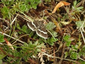

Image Gallery
No gallery images found for this moth.
Temporal Distribution Chart
Adults: (between 1970 - 2025)
Distribution Map for Pyrausta cingulata
↳ from 2026+
↳ 18 from 2020 - 2025
↳ 33 from Before 2020
If the Map Layers function fails, just refresh the page and it should be OK after. Use the +- zoom on the top left, or on a tablet, use two fingers to zoom. Remember, the last layer you ticked is the one which displays the popup information - they sit on top of each other - de-select then re-select, to see the popup values.
Bedrock Geology ** indirectly affects moth distribution by influencing the type of habitat and food plants available in an area. In turn, this may affect the types of moths that can thrive, or where they can most likely be found.
NBN Atlas UK Distribution for – Pyrausta cingulata
⚠️ Please wait for the map to load fully – do not click the link shown.
Note – the NBN Atlas datasets are listed in the map below and vary in their currency (uptodateness) – however,
the map does give a general indication of the moth's distribution across the UK.
Monthly Records By Year:
Pyrausta cingulata
( data includes both Larvae and Adult Stages )
Monthly Counts By Year:
Pyrausta cingulata
( data is based on 'Adult' stage records only )
First/Last Recorded Dates: Pyrausta cingulata
Adult-only & Anything [Larvae, Pupae, Adult, Mines]
Shading shows moth presence between dates
Click the colour discs below to Select/De-select as Required
Recordings By Year: Pyrausta cingulata
( All data includes both Larvae and Adult Stages )
Annual Growth Rate (AGR): Pyrausta cingulata
AGR: 0% | Total % Change: 0%
Hectad (10kmx10km) Coverage: Pyrausta cingulata
( data includes both Larvae and Adult Stages )
Flight Periods – Indicative –vs– Recorded Data
Pyrausta cingulata
Pyrausta cingulata
Flight Period chart – the grey hatched area above, which can cross one or more months, pictorially represents the best guess we have for this moth's flight periods [month/s]. The coloured lines represent the actual months seen in flight, from site observation records received between 2020-2026.
Records Behind the Map and Charts - Pyrausta cingulata – 51 records available
Listed by Year - descending - scroll across to see all table columns
| Site Name | Tetrad | Date | Count | Stage | Recorder | Source | RecordKey |
|---|---|---|---|---|---|---|---|
| Gang Mine, Cromford | SK25X | 03/06/2025 | 1 | Adult | Ashton, Clive | vc57_irecords_extract | iBRC42040684 |
| Tansley Dale | SK17S | 19/05/2025 | 1 | Adult | Taylor, Sue | vc57_irecords_extract | iBRC48471556 |
| upper cromford garden | SK25Y | 12/08/2024 | 1 | Adult | Ashton, Clive | vc57_irecords_extract | iBRC37874152 |
| Tansley Dale | SK17S | 10/08/2023 | 2 | Adult | Hewitt, Jane | vc57_irecords_extract | iBRC34361711 |
| Longstone Cliff | SK17W | 03/06/2023 | 3 | Adult | Hartley, Alan | vc57_irecords_extract | iBRC30673753 |
| Cressbrook Dale, Derbyshire | SK17S | 30/05/2023 | 4 | Adult | Miles, Claire | vc57_irecords_extract | iBRC30591253 |
| Derbyshire, UK | SK17D | 03/08/2022 | 1 | Adult | Ian M. White | vc57_irecords_extract | iBRC27462101 |
| Derbyshire, UK | SK17I | 27/07/2022 | 1 | Adult | Ian M. White | vc57_irecords_extract | iBRC27339694 |
| Hay Dale NNR, Derbyshire, UK | SK17D | 03/06/2022 | 2 | Adult | Miles, Claire | vc57_irecords_extract | iBRC28684642 |
| Derbyshire, England, United Kingdom | SK17I | 20/05/2022 | 1 | Adult | Orridge, Steve | vc57_irecords_extract | iBRC25440514 |
| Hartington Meadows | SK16K | 14/05/2022 | 1 | Adult | Marriott, Ant | vc57_irecords_extract | iBRC25372915 |
| Derbyshire, UK | SK17H | 31/07/2021 | 1 | Adult | MarkCocker | vc57_irecords_extract | iBRC34010335 |
| Gang Mine, Middleton | SK25X | 14/07/2021 | 1 | Adult | Mahadevan, Nikki | vc57_irecords_extract | iBRC21062311 |
| UK, Derbyshire, Cressbrook Dale | SK17S | 04/06/2021 | 2 | Adult | Miles, Claire | vc57_irecords_extract | iBRC29583199 |
| Derbyshire, UK | SK17I | 29/05/2021 | 1 | Adult | Ian M. White | vc57_irecords_extract | iBRC29264992 |
| Longstone Edge | SK17W | 29/04/2021 | 1 | Adult | Watchorn, Andrew | vc57_irecords_extract | iBRC29116066 |
| Monk's Dale | SK17G | 19/05/2020 | 1 | Adult | Ian M. White | vc57_irecords_extract | iBRC29251459 |
| Monk's Dale | SK17H | 19/05/2020 | 1 | Adult | Ian M. White | vc57_irecords_extract | iBRC27459097 |
| Dovedale | SK15K | 01/08/2011 | 4 | Adult | D. Grundy | vc57_danes_bc_data | LC000334001COU1M |
| Dovedale | SK15K | 01/08/2011 | 1 | Adult | D. Grundy | vc57_danes_bc_data | LC000334001COU2D |
| Dovedale | SK15K | 01/08/2011 | 13 | Adult | D. Grundy | vc57_danes_bc_data | LC000334001COXVC |
| Dovedale | SK15K | 01/08/2011 | 20 | Adult | D. Grundy | vc57_danes_bc_data | LC000334001CP7EQ |
| Dovedale | SK15K | 01/08/2011 | 11 | Adult | D. Grundy | vc57_danes_bc_data | LC000334001CP7F8 |
| Dovedale | SK15K | 01/08/2011 | 18 | Adult | D. Grundy | vc57_danes_bc_data | LC000334001CP9T4 |
| Dovedale | SK15K | 11/07/2011 | 1 | Adult | H. John;M. Bellingham | vc57_danes_bc_data | LC000334001CP76V |
| Dovedale, Lin Dale | SK15K | 15/08/2010 | 5 | Adult | Finch, Graham Leonard | vc57_irecords_extract | iBRC35106363 |
| Dovedale | SK15K | 15/08/2010 | 4 | Adult | D. Grundy | vc57_danes_bc_data | LC000334001COTL7 |
| Dovedale | SK15K | 15/08/2010 | 1 | Adult | D. Grundy | vc57_danes_bc_data | LC000334001COTLE |
| Dovedale | SK15K | 15/08/2010 | 13 | Adult | D. Grundy | vc57_danes_bc_data | LC000334001COTLU |
| Dovedale (Lin Dale) | SK15K | 15/08/2010 | 5 | Adult | Finch, Graham Leonard | vc57_danes_bc_data | LC000334001COXGG |
| Dovedale | SK15K | 15/08/2010 | 3 | Adult | D. Grundy | vc57_danes_bc_data | LC000334001CP9S0 |
| Dovedale | SK15K | 15/08/2010 | 1 | Adult | D. Grundy | vc57_danes_bc_data | LC000334001CP9SH |
| Dovedale | SK15K | 15/08/2010 | 1 | Adult | D. Grundy | vc57_danes_bc_data | LC000334001CP9ST |
| Dovedale | SK15K | 30/07/2010 | 6 | Adult | M.J. Dale | vc57_danes_bc_data | LC000334001COTHV |
| Dovedale | SK15K | 30/07/2010 | 5 | Adult | M.J. Dale | vc57_danes_bc_data | LC000334001COTIC |
| Dovedale (stepping stones) | SK15K | 30/07/2010 | 1 | Adult | D. Grundy | vc57_danes_bc_data | LC000334001COXDK |
| Dovedale | SK15K | 30/07/2010 | 1 | Adult | D. Grundy | vc57_danes_bc_data | LC000334001CP68E |
| Dovedale | SK15K | 30/07/2010 | 1 | Adult | D. Grundy | vc57_danes_bc_data | LC000334001CP9RD |
| Dovedale | SK15K | 25/07/2010 | 2 | Adult | D. Grundy | vc57_danes_bc_data | LC000334001COTFU |
| Dovedale | SK15K | 25/07/2010 | 2 | Adult | D. Grundy | vc57_danes_bc_data | LC000334001CP63D |
| Dovedale | SK15K | 25/07/2010 | 1 | Adult | D. Grundy | vc57_danes_bc_data | LC000334001CP63P |
| Lathkill Dale (open dale west of main ash woodland), Bakewell | SK16X | 11/08/2007 | 1 | Adult | Dave Budworth;N.J. Ward;W. Soar | vc57_danes_bc_data | LC000334001COZVC |
| Lathkil Dale | SK16Y | 11/08/2007 | 1 | Adult | Soar, Will | vc57_irecords_extract | iBRC34680102 |
| Hassop Common (east), Hassop | SK27G | 07/07/2007 | 1 | Adult | D. Whiteley | vc57_danes_bc_data | LC000334001CP3WR |
| Hassop Common, Hassop | SK27G | 22/05/2007 | 100 | Adult | D. Whiteley | vc57_danes_bc_data | LC000334001COWAP |
| The Hollies,Station Rd,Darley Dale | SK26R | 26/07/2006 | 1 | Adult | Roddis, Simon | vc57_danes_bc_data | LC000334001CORVR |
| Flash Lane, Beeley Moor area | SK26X | 08/08/1997 | 1 | Adult | B.L. Statham | vc57_danes_bc_data | LC000334001COZMV |
| Far Cross,Cavendish Park,Matlock | SK36A | 08/08/1997 | 1 | Adult | B.L. Statham | vc57_danes_bc_data | LC000334001COZMX |
| Hassop, Baslow | SK27G | 17/05/1997 | 1 | Adult | R.F. Botterill | vc57_danes_bc_data | LC000334001COZLF |
| Coombs Dale,Stoney Middleton | SK27C | 24/06/1995 | 1 | Adult | VC57 Derbyshire Recorder | vc57_danes_bc_data | LC000334001COQU6 |
| Hopton Wood Quarry (site not precise) | SK25M | 07/06/1970 | 1 | Adult | VC57 Derbyshire Recorder | vc57_danes_bc_data | LC000334001COQI9 |