

 – click for Adult Macro Verification Guidelines
 – Rare / Uncommon / Scarce
Confusion Species: The most likely confusion species are Common Wainscot and Smoky Wainscot.
Hindwing is whitish to pale greyish with a dark discal mark and a row of short dark postmedian dashes. Another identification aid is the white and brown double striped collar, giving the illusion the moth is wearing a headband, if viewed from the front.
Forewing: 14-18mm


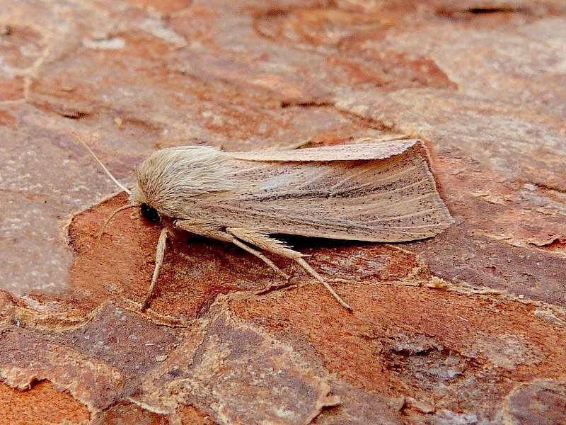

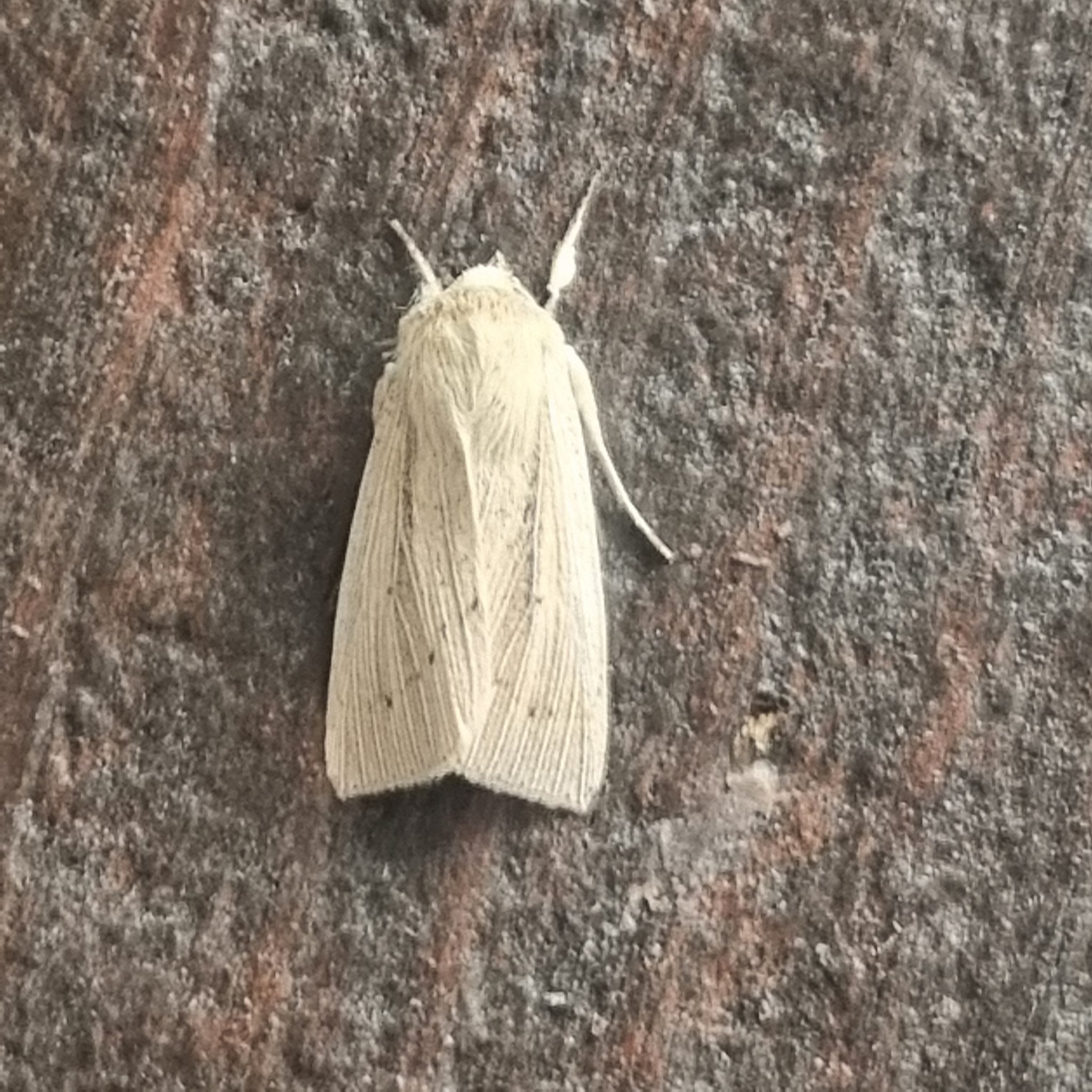
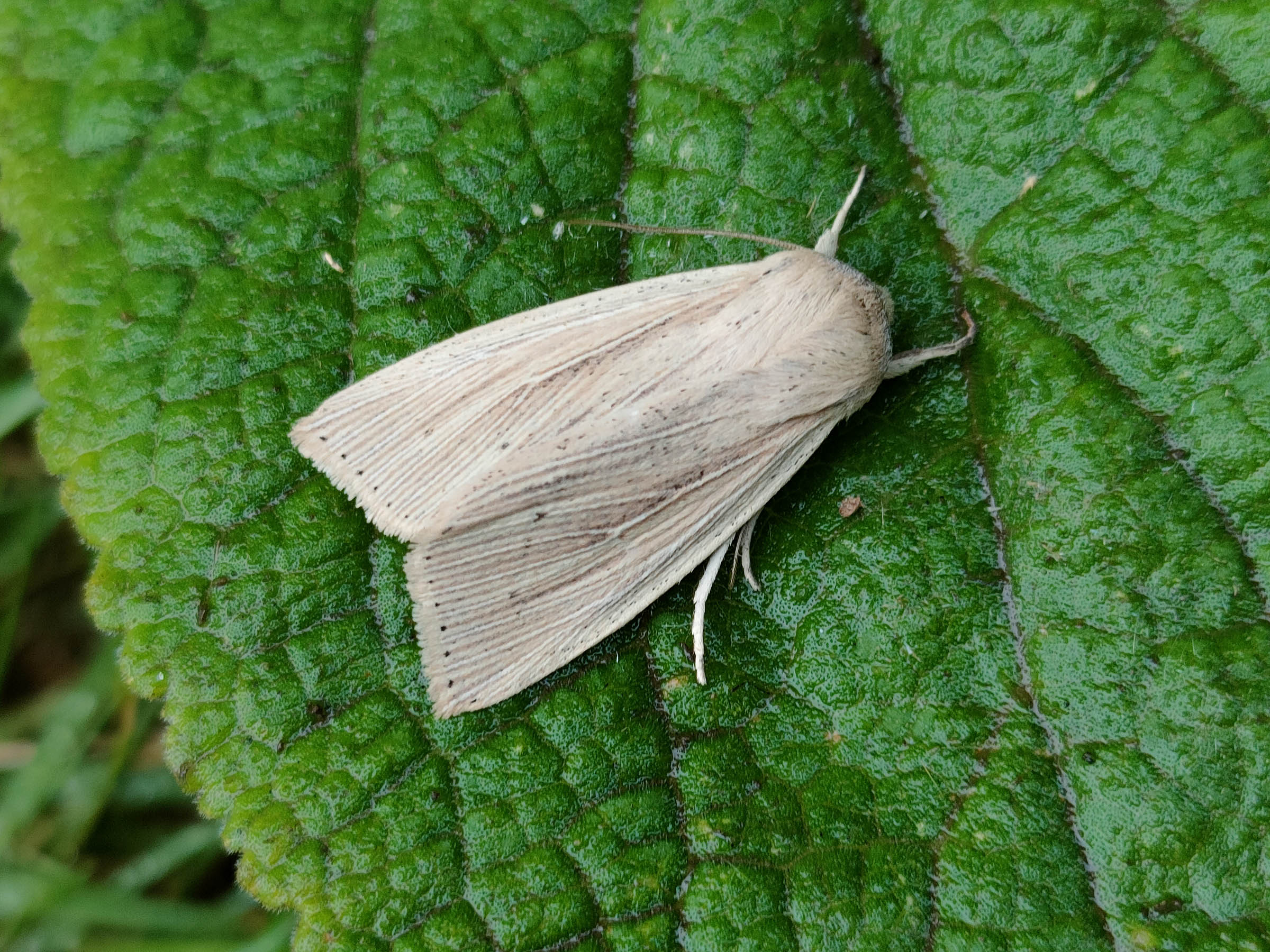
Image Gallery

Temporal Distribution Chart
Adults: (between 1970 - 2026)
Distribution Map for Mythimna straminea
↳ 2 from 2026+
↳ 18 from 2020 - 2025
↳ 37 from Before 2020
If the Map Layers function fails, just refresh the page and it should be OK after. Use the +- zoom on the top left, or on a tablet, use two fingers to zoom. Remember, the last layer you ticked is the one which displays the popup information - they sit on top of each other - de-select then re-select, to see the popup values.
Bedrock Geology ** indirectly affects moth distribution by influencing the type of habitat and food plants available in an area. In turn, this may affect the types of moths that can thrive, or where they can most likely be found.
NBN Atlas UK Distribution for – Mythimna straminea
⚠️ Please wait for the map to load fully – do not click the link shown.
Note – the NBN Atlas datasets are listed in the map below and vary in their currency (uptodateness) – however,
the map does give a general indication of the moth's distribution across the UK.
Monthly Records By Year:
Mythimna straminea
( data includes both Larvae and Adult Stages )
Monthly Counts By Year:
Mythimna straminea
( data is based on 'Adult' stage records only )
First/Last Recorded Dates: Mythimna straminea
Adult-only & Anything [Larvae, Pupae, Adult, Mines]
Shading shows moth presence between dates
Click the colour discs below to Select/De-select as Required
Recordings By Year: Mythimna straminea
( All data includes both Larvae and Adult Stages )
Annual Growth Rate (AGR): Mythimna straminea
AGR: 0% | Total % Change: 0%
Hectad (10kmx10km) Coverage: Mythimna straminea
( data includes both Larvae and Adult Stages )
Flight Periods – Indicative –vs– Recorded Data
Mythimna straminea
Mythimna straminea
Flight Period chart – the grey hatched area above, which can cross one or more months, pictorially represents the best guess we have for this moth's flight periods [month/s]. The coloured lines represent the actual months seen in flight, from site observation records received between 2020-2026.
Records Behind the Map and Charts - Mythimna straminea – 57 records available
Listed by Year - descending - scroll across to see all table columns
| Site Name | Tetrad | Date | Count | Stage | Recorder | Source | RecordKey |
|---|---|---|---|---|---|---|---|
| Staveley Derbyshire | SK47H | 26/06/2026 | 1 | adult | Morris, Sid | vc57_irecords_extract | iBRC54213699 |
| Darwin Forest | SK26X | 19/06/2026 | 1 | adult | Evans, Dave | vc57_irecords_extract | iBRC53814448 |
| Staveley Derbyshire | SK47H | 11/07/2025 | 1 | Adult | Morris, Sid | vc57_irecords_extract | iBRC43309063 |
| Woodland Ave | SK43R | 05/07/2025 | 2 | Adult | Thorpe, Steve | vc57_irecords_extract | iBRC48391231 |
| Belper, Derbyshire | SK34N | 28/06/2025 | 1 | Adult | Newcombe, Dave | vc57_irecords_extract | iBRC43963139 |
| Woodland Ave | SK43R | 11/08/2023 | 4 | Adult | Thorpe, Steve | vc57_irecords_extract | iBRC33497037 |
| Woodland Ave | SK43R | 28/07/2023 | 4 | Adult | Thorpe, Steve | vc57_irecords_extract | iBRC33496878 |
| Woodland Ave | SK43R | 21/07/2023 | 1 | Adult | Thorpe, Steve | vc57_irecords_extract | iBRC33496801 |
| Staveley Derbyshire | SK47H | 17/07/2023 | 1 | Adult | Morris, Sid | vc57_irecords_extract | iBRC31671390 |
| Woodland Ave | SK43R | 05/08/2022 | 1 | Adult | Thorpe, Steve | vc57_irecords_extract | iBRC33495110 |
| Woodland Ave | SK43R | 19/07/2022 | 1 | Adult | Thorpe, Steve | vc57_irecords_extract | iBRC27846301 |
| Woodland Ave | SK43R | 13/08/2021 | 1 | Adult | Thorpe, Steve | vc57_irecords_extract | iBRC33499289 |
| Woodland Ave | SK43R | 08/08/2021 | 1 | Adult | Thorpe, Steve | vc57_irecords_extract | iBRC33499230 |
| Woodland Ave | SK43R | 01/08/2021 | 4 | Adult | Thorpe, Steve | vc57_irecords_extract | iBRC33499180 |
| Norton Lees | SK38L | 30/07/2021 | 1 | Adult | Mella, Pete | vc57_irecords_extract | iBRC50549526 |
| Woodland Ave | SK43R | 24/07/2021 | 2 | Adult | Thorpe, Steve | vc57_irecords_extract | iBRC33499111 |
| Woodland Ave | SK43R | 14/08/2020 | 1 | Adult | Thorpe, Steve | vc57_irecords_extract | iBRC33502112 |
| Main Street, Kings Newton | SK32Y | 12/08/2020 | 1 | Adult | Soar, Will | vc57_irecords_extract | iBRC34062673 |
| Woodland Ave | SK43R | 09/08/2020 | 2 | Adult | Thorpe, Steve | vc57_irecords_extract | iBRC33502037 |
| Woodland Ave | SK43R | 06/08/2020 | 1 | Adult | Thorpe, Steve | vc57_irecords_extract | iBRC33501967 |
| Belper | SK34U | 27/06/2017 | 1 | Adult | Evans, Dave | vc57_irecords_extract | iBRC38609914 |
| Hardhurst Rd, Alvaston, Derby | SK33W | 16/08/2014 | 1 | Adult | I. Gardler | vc57_danes_bc_data | LC000334001WP4DY |
| Pleasley Pit CP, Pleasley | SK46X | 24/07/2014 | 1 | Adult | B.J.N. Hill | vc57_danes_bc_data | LC000334001WQFR0 |
| Hardhurst Rd, Alvaston, Derby | SK33W | 23/07/2014 | 1 | Adult | I. Gardler | vc57_danes_bc_data | LC000334001WPPOT |
| Hardhurst Rd, Alvaston, Derby | SK33W | 19/07/2014 | 1 | Adult | I. Gardler | vc57_danes_bc_data | LC000334001WQFP6 |
| Pleasley Pit CP, Pleasley | SK46X | 19/07/2014 | 1 | Adult | B.J.N. Hill | vc57_danes_bc_data | LC000334001WPO9A |
| Hardhurst Rd, Alvaston, Derby | SK33W | 25/07/2013 | 2 | Adult | I. Gardler | vc57_danes_bc_data | LC000334001OJX73 |
| Hardhurst Rd, Alvaston, Derby | SK33W | 25/07/2013 | 1 | Adult | I. Gardler | vc57_danes_bc_data | LC000334001OJX74 |
| Hardhurst Rd, Alvaston, Derby | SK33W | 25/07/2013 | 1 | Adult | I. Gardler | vc57_danes_bc_data | LC000334001WPMVU |
| Hardhurst Rd, Alvaston, Derby | SK33W | 25/07/2013 | 2 | Adult | I. Gardler | vc57_danes_bc_data | LC000334001WPMVV |
| Hardhurst Rd, Alvaston, Derby | SK33W | 22/07/2013 | 1 | Adult | I. Gardler | vc57_danes_bc_data | LC000334001OLCJS |
| Hardhurst Rd, Alvaston, Derby | SK33W | 22/07/2013 | 1 | Adult | I. Gardler | vc57_danes_bc_data | LC000334001WOU90 |
| Burnaston (Toyota Plant NR), Derby | SK23V | 20/07/2013 | 2 | Adult | Dave Budworth;B.G. Sewell | vc57_danes_bc_data | LC000334001OJX3V |
| Burnaston (Toyota Plant NR), Derby | SK23V | 20/07/2013 | 2 | Adult | Dave Budworth;B.G. Sewell | vc57_danes_bc_data | LC000334001WP3ZR |
| Hardhurst Rd, Alvaston, Derby | SK33W | 17/07/2013 | 1 | Adult | I. Gardler | vc57_danes_bc_data | LC000334001OKB89 |
| Hardhurst Rd, Alvaston, Derby | SK33W | 17/07/2013 | 1 | Adult | I. Gardler | vc57_danes_bc_data | LC000334001WQ7M4 |
| Pleasley NR (Pit Head) | SK46X | 11/08/2012 | 1 | Adult | B.J.N. Hill | vc57_danes_bc_data | LC000334001OL931 |
| Hardhurst Rd, Alvaston, Derby | SK33W | 10/08/2012 | 1 | Adult | I. Gardler | vc57_danes_bc_data | LC000334001WQBNW |
| Ault Hucknall,Glapwell | SK46S | 23/07/2012 | 1 | Adult | M.E. Bradley | vc57_danes_bc_data | LC000334001OL7Z7 |
| Williamthorpe LNR,Holmewood | SK46I | 21/08/2011 | 2 | Adult | BUDWORTH, Mr D., CLARKE, Mr D.A., HARRIS, Mrs G., | vc57_danes_bc_data | LC000334001OKFVQ |
| Pleasley Pit (woodyard) | SK46X | 07/06/2008 | 1 | Adult | B. Elliott;C. Stubbs | vc57_danes_bc_data | LC000334001OJK82 |
| Drakelow NR,Burton on Trent | SK22F | 08/09/2007 | 1 | Adult | M.J. Williams | vc57_danes_bc_data | LC000334001OKIUV |
| Drakelow NR,Burton on Trent | SK22F | 08/09/2007 | 1 | Adult | M.J. Williams | vc57_danes_bc_data | LC000334001WOO3H |
| Drakelow NR,Burton on Trent | SK22F | 31/08/2007 | 1 | Adult | M.J. Williams | vc57_danes_bc_data | LC000334001OJZ9I |
| Drakelow NR,Burton on Trent | SK22F | 31/08/2007 | 1 | Adult | M.J. Williams | vc57_danes_bc_data | LC000334001WOXSB |
| Briar Close,Newhall,Swadlincote | SK22V | 18/07/2007 | 1 | Adult | K. Peach | vc57_danes_bc_data | LC000334001OJYVG |
| Briar Close,Newhall,Swadlincote | SK22V | 18/07/2007 | 1 | Adult | K. Peach | vc57_danes_bc_data | LC000334001WQEMZ |
| Pond House, Mapperley, Shipley Park | SK44G | 22/07/1989 | 1 | Adult | T. Duro | vc57_danes_bc_data | LC000334001OI0JV |
| Pond House, Mapperley, Shipley Park | SK44G | 22/07/1989 | 1 | Adult | T. Duro | vc57_danes_bc_data | LC000334001WPX0P |
| Pond House, Mapperley, Shipley Park | SK44G | 15/07/1988 | 1 | Adult | T. Duro | vc57_danes_bc_data | LC000334001OITC2 |
| Pond House, Mapperley, Shipley Park | SK44G | 15/07/1988 | 1 | Adult | T. Duro | vc57_danes_bc_data | LC000334001WQA90 |
| Carr Vale NR,Bolsover | SK47K | 23/08/1987 | 1 | Adult | A. Jenkins | vc57_danes_bc_data | LC000334001OIT75 |
| Sawley Tip, Sawley, Long Eaton | SK43V | 08/07/1982 | 3 | Adult | A. Braddock | vc57_danes_bc_data | LC000334001OIOTG |
| Wilmot St, Sawley, Long Eaton | SK43R | 07/07/1982 | 8 | Adult | A. Braddock | vc57_danes_bc_data | LC000334001OIOSZ |
| Wilmot St, Sawley, Long Eaton | SK43R | 07/07/1982 | 8 | Adult | A. Braddock | vc57_danes_bc_data | LC000334001WPJAT |
| Newbold Ave, Chesterfield | SK37R | 05/08/1970 | 1 | Adult | VC57 Derbyshire Recorder | vc57_danes_bc_data | LC000334001OIHVB |
| Newbold Ave, Chesterfield | SK37R | 05/08/1970 | 1 | Adult | B. Elliott | vc57_danes_bc_data | LC000334001WQ9WS |