 – click for General Verification Guidelines | – click for Specific Verification Guidelines
  – Generally Common / Widespread
  – Day-flying
Confusion Species: Nematopogon schwarziellus, Nematopogon metaxella
Blue-coded] moths is not displayed/updated in this tab. However, all verified records for this moth are listed in the RECORDS tab below. 


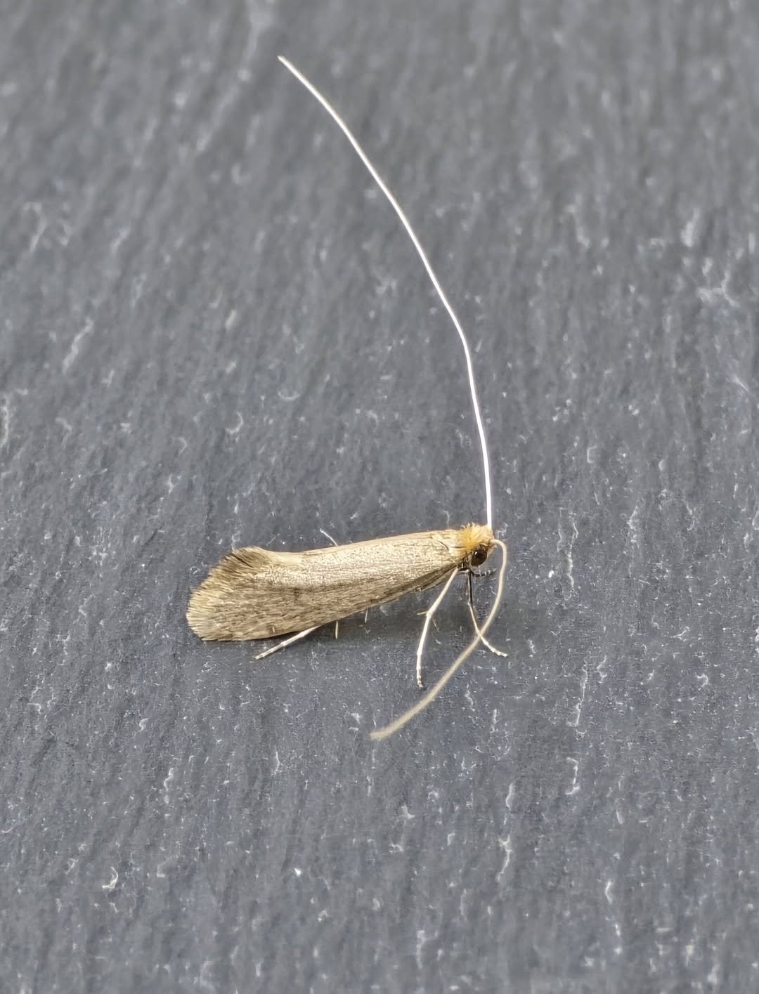
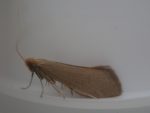
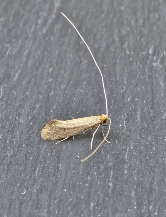
Image Gallery

Temporal Distribution Chart
Adults: (between 1979 - 2026)
Distribution Map for Nematopogon swammerdamella
↳ 8 from 2026+
↳ 31 from 2020 - 2025
↳ 31 from Before 2020
If the Map Layers function fails, just refresh the page and it should be OK after. Use the +- zoom on the top left, or on a tablet, use two fingers to zoom. Remember, the last layer you ticked is the one which displays the popup information - they sit on top of each other - de-select then re-select, to see the popup values.
Bedrock Geology ** indirectly affects moth distribution by influencing the type of habitat and food plants available in an area. In turn, this may affect the types of moths that can thrive, or where they can most likely be found.
NBN Atlas UK Distribution for – Nematopogon swammerdamella
⚠️ Please wait for the map to load fully – do not click the link shown.
Note – the NBN Atlas datasets are listed in the map below and vary in their currency (uptodateness) – however,
the map does give a general indication of the moth's distribution across the UK.
Monthly Records By Year:
Nematopogon swammerdamella
( data includes both Larvae and Adult Stages )
Monthly Counts By Year:
Nematopogon swammerdamella
( data is based on 'Adult' stage records only )
First/Last Recorded Dates: Nematopogon swammerdamella
Adult-only & Anything [Larvae, Pupae, Adult, Mines]
Shading shows moth presence between dates
Click the colour discs below to Select/De-select as Required
Recordings By Year: Nematopogon swammerdamella
( All data includes both Larvae and Adult Stages )
Annual Growth Rate (AGR): Nematopogon swammerdamella
AGR: 0.54% | Total % Change: 12.5%
Hectad (10kmx10km) Coverage: Nematopogon swammerdamella
( data includes both Larvae and Adult Stages )
Flight Periods – Indicative –vs– Recorded Data
Nematopogon swammerdamella
Nematopogon swammerdamella
Flight Period chart – the grey hatched area above, which can cross one or more months, pictorially represents the best guess we have for this moth's flight periods [month/s]. The coloured lines represent the actual months seen in flight, from site observation records received between 2020-2026.
Records Behind the Map and Charts - Nematopogon swammerdamella – 70 records available
Listed by Year - descending - scroll across to see all table columns
| Site Name | Tetrad | Date | Count | Stage | Recorder | Source | RecordKey |
|---|---|---|---|---|---|---|---|
| Belper | SK34N | 23/06/2026 | 1 | adult | Evans, Dave | vc57_irecords_extract | iBRC53992602 |
| DWT Wyver Lane | SK34P | 09/06/2026 | 1 | adult | Evans, Dave | vc57_irecords_extract | iBRC53283095 |
| Heage | SK35Q | 06/06/2026 | 1 | adult | Evans, Dave | vc57_irecords_extract | iBRC53198563 |
| Staveley garden SYA | SK47H | 05/06/2026 | 1 | adult | Radford, Mark | vc57_irecords_extract | iBRC53187744 |
| Markham Vale South Tip , Derbyshire | SK47L | 24/05/2026 | 1 | adult | Sid Morris ( M.V. trapping club ) | vc57_irecords_extract | iBRC52666075 |
| upper cromford garden | SK25Y | 22/05/2026 | 2 | adult | Ashton, Clive | vc57_irecords_extract | iBRC52546939 |
| rose end meadows | SK25Y | 10/05/2026 | 1 | adult | Ashton, Clive | vc57_irecords_extract | iBRC52138412 |
| upper cromford garden | SK25Y | 08/05/2026 | 1 | adult | Ashton, Clive | vc57_irecords_extract | iBRC52110744 |
| Derbyshire Wild Life Trust Long Clough, Herod Clough | SK09G | 24/05/2025 | 1 | Adult | Heintzen, Christian | vc57_irecords_extract | iBRC43979335 |
| Spring Wood, Calke | SK32W | 24/05/2025 | 1 | Adult | Gregory, Neil | vc57_irecords_extract | iBRC41789015 |
| Longdendale, Wildboar Clough Woodland | SK09U | 20/05/2025 | 2 | Adult | Heintzen, Christian | vc57_irecords_extract | iBRC43979251 |
| DWT Wyver Lane | SK34P | 20/05/2025 | 1 | Adult | Evans, Dave | vc57_irecords_extract | iBRC41723822 |
| Sheffield | SK38M | 20/05/2025 | 1 | Adult | Turner, Jan | vc57_irecords_extract | iBRC41825716 |
| Simmondley Oak wood | SK09B | 19/05/2025 | 2 | Adult | Heintzen, Christian | vc57_irecords_extract | iBRC43979214 |
| Belper, Derbyshire | SK34N | 19/05/2025 | 1 | Adult | Newcombe, Dave | vc57_irecords_extract | iBRC43709743 |
| Buxton: Light Wood | SK07M | 18/05/2025 | 1 | Adult | Harvey, Martin C. | vc57_irecords_extract | iBRC41755360 |
| Lightwood Reserve, Buxton | SK07M | 18/05/2025 | 1 | Adult | Taylor, Sue | vc57_irecords_extract | iBRC42059515 |
| Derbyshire Wild Life Trust Long Clough | SK09G | 17/05/2025 | 1 | Adult | Heintzen, Christian | vc57_irecords_extract | iBRC43979179 |
| upper cromford garden | SK25Y | 17/05/2025 | 1 | Adult | Ashton, Clive | vc57_irecords_extract | iBRC41661822 |
| upper cromford garden | SK25Y | 16/05/2025 | 1 | Adult | Ashton, Clive | vc57_irecords_extract | iBRC41639794 |
| upper cromford garden | SK25Y | 15/05/2025 | 1 | Adult | Ashton, Clive | vc57_irecords_extract | iBRC41616390 |
| Derbyshire Wild Life Trust Long Clough | SK09G | 11/05/2025 | 1 | Adult | Heintzen, Christian | vc57_irecords_extract | iBRC43979072 |
| upper cromford garden | SK25Y | 10/05/2025 | 1 | Adult | Ashton, Clive | vc57_irecords_extract | iBRC41501821 |
| Froggatt, Hope Valley | SK27N | 10/05/2025 | 1 | Adult | Barnacle, Bryan | vc57_irecords_extract | iBRC41499663 |
| upper cromford garden | SK25Y | 07/05/2025 | 2 | Adult | Ashton, Clive | vc57_irecords_extract | iBRC41431600 |
| Cromford Moor | SK25X | 06/05/2025 | 1 | Adult | Ashton, Clive | vc57_irecords_extract | iBRC41401581 |
| Derbyshire Wild Life Trust Long Clough | SK09G | 03/05/2025 | 1 | Adult | Heintzen, Christian | vc57_irecords_extract | iBRC43979023 |
| Cotleigh Crescent, Hackenthorpe | SK48B | 03/05/2025 | 1 | Adult | Leanne Wall | vc57_irecords_extract | iBRC41475858 |
| Cross Green, Matlock DEJW, UK | SK26Q | 01/06/2024 | 1 | Adult | Moores, Stephen | vc57_irecords_extract | iBRC36243657 |
| Baslow, Bakewell DEPQ, UK | SK27R | 31/05/2024 | 1 | Adult | Martin, Lee | vc57_irecords_extract | iBRC36196066 |
| upper cromford garden | SK25Y | 25/05/2024 | 1 | Adult | Ashton, Clive | vc57_irecords_extract | iBRC36113935 |
| Longdendale, Wildboar Clough | SK09U | 19/05/2024 | 1 | Adult | Heintzen, Christian | vc57_irecords_extract | iBRC36371788 |
| Blacka Moor | SK28V | 05/05/2024 | 1 | Adult | Higginson-Tranter, Dave | vc57_irecords_extract | iBRC35811100 |
| Glossop, Bray Clough | SK09K | 01/05/2024 | 1 | Adult | Heintzen, Christian | vc57_irecords_extract | iBRC36371561 |
| Glossop, The Twitchlings | SK09K | 03/06/2023 | 1 | Adult | Heintzen, Christian | vc57_irecords_extract | iBRC36336105 |
| Staveley Derbyshire | SK47H | 17/05/2023 | 1 | Adult | Morris, Sid | vc57_irecords_extract | iBRC30392188 |
| Derbyshire Wild Life Trust Long Clough | SK09G | 16/05/2023 | 2 | Adult | Heintzen, Christian | vc57_irecords_extract | iBRC36335953 |
| Derbyshire Wild Life Trust Long Clough | SK09G | 03/05/2023 | 1 | Adult | Heintzen, Christian | vc57_irecords_extract | iBRC36335872 |
| Darley Bridge | SK26K | 24/04/2021 | 1 | Adult | Moores, Stephen | vc57_irecords_extract | iBRC22620145 |
| Birch Vale | SK08I | 01/06/2019 | 1 | Adult | Hewitt, Jane | vc57_irecords_extract | iBRC35073490 |
| Williamthorpe, Derbyshire | SK46I | 17/05/2016 | 1 | Adult | Plant, Stephen | vc57_irecords_extract | iBRC35009518 |
| Hartshorne Wood, Hartshorne, Swadlincote | SK32G | 13/05/2015 | 1 | Adult | Dave Budworth | vc57_danes_bc_data | LC000334001CP9N2 |
| Robin Wood, Ticknall | SK32S | 26/05/2014 | 1 | Adult | Dave Budworth | vc57_danes_bc_data | LC000334001COV0W |
| Via Gellia | SK25T | 04/06/2013 | 1 | Adult | Thorpe, Steve | vc57_irecords_extract | iBRC33507796 |
| Padley Gorge (Longshaw Est) | SK27P | 03/06/2013 | 20 | Adult | D. Mcgeever | vc57_danes_bc_data | LC000334001COUQM |
| Bow Wood,Holloway,Matlock | SK35D | 31/05/2013 | 1 | Adult | F. Harrison | vc57_danes_bc_data | LC000334001COUQA |
| Carr Wood | SK45A | 22/06/2012 | 1 | Adult | Thorpe, Steve | vc57_irecords_extract | iBRC33510368 |
| Carr Wood, Ripley | SK45A | 22/06/2012 | 1 | Adult | Thorpe, Steve | vc57_danes_bc_data | LC000334001CP7TK |
| Findern Marina, Willington, Derby | SK32E | 12/06/2012 | 1 | Adult | M.J. Williams | vc57_danes_bc_data | LC000334001CP7S4 |
| Duffield Rd, Allestree, Derby | SK34K | 06/06/2012 | 1 | Adult | P. Smith | vc57_danes_bc_data | LC000334001CP7RU |
| Duffield Rd, Allestree, Derby | SK34K | 04/06/2012 | 1 | Adult | P. Smith | vc57_danes_bc_data | LC000334001CP7RP |
| Carr Wood | SK45A | 26/05/2012 | 1 | Adult | Thorpe, Steve | vc57_irecords_extract | iBRC33510070 |
| Carr Wood, Ripley | SK45A | 26/05/2012 | 1 | Adult | Thorpe, Steve | vc57_danes_bc_data | LC000334001CP0CG |
| Clough Wood,Darley Dale | SK26K | 06/05/2011 | 1 | Adult | A. Butler | vc57_danes_bc_data | LC000334001CP6UY |
| High Tor, Matlock | SK25Z | 01/05/2011 | 1 | Adult | Thorpe, Steve | vc57_irecords_extract | iBRC33512222 |
| Bamford St,Ripley | SK34Z | 01/05/2011 | 1 | Adult | Thorpe, Steve | vc57_danes_bc_data | LC000334001CP6U8 |
| Crich Chase,Ambergate | SK35L | 01/05/2011 | 1 | Adult | K.R. Huston | vc57_danes_bc_data | LC000334001CP6U5 |
| The Hollies,Station Rd,Darley Dale | SK26R | 15/05/2007 | 1 | Adult | Roddis, Simon | vc57_danes_bc_data | LC000334001CP3RP |
| The Hollies,Station Rd,Darley Dale | SK26R | 08/05/2007 | 1 | Adult | Roddis, Simon | vc57_danes_bc_data | LC000334001CP3RO |
| Church St,Holloway,Matlock | SK35I | 26/05/2005 | 1 | Adult | F. Harrison | vc57_danes_bc_data | LC000334001CP2GO |
| Church St,Holloway,Matlock | SK35I | 25/05/2005 | 1 | Adult | F. Harrison | vc57_danes_bc_data | LC000334001COVRZ |
| Church St,Holloway,Matlock | SK35I | 24/05/2005 | 1 | Adult | F. Harrison | vc57_danes_bc_data | LC000334001COVRY |
| FOREMARK RESERVOIR | SK32G | 25/05/2004 | 1 | Adult | Davison, Tony | vc57_irecords_extract | iBRC33454994 |
| Carvers Rocks, Hartshorne, Swadlincote | SK32G | 25/05/2004 | 1 | Adult | A. Davison;N. Topliss | vc57_danes_bc_data | LC000334001COVKG |
| The Hollies,Station Rd,Darley Dale | SK26R | 10/05/2004 | 1 | Adult | Roddis, Simon | vc57_danes_bc_data | LC000334001COR5L |
| Crich Chase (Holly tree area) (site not precise) | SK35L | 18/05/1991 | 1 | Adult | VC57 Derbyshire Recorder | vc57_danes_bc_data | LC000334001COV81 |
| Crich Chase, Ambergate (site not precise) | SK35L | 04/06/1983 | 1 | Adult | VC57 Derbyshire Recorder | vc57_danes_bc_data | LC000334001CP0OW |
| Carvers Rocks NR, Hartshorne, Swadlincote (site not precise) | SK32G | 19/05/1981 | 1 | Adult | YOUNG, Mr D.A., HARRISON, Mr F., BEAUMONT, Mr H.E. | vc57_danes_bc_data | LC000334001COZJH |
| Carvers Rocks NR,Hartshorne,Swadlincote | SK32G | 03/06/1979 | 1 | Adult | D.A. Young | vc57_danes_bc_data | LC000334001COQAX |
| Carvers Rocks NR,Hartshorne,Swadlincote | SK32G | 25/05/1979 | 1 | Adult | D.A. Young | vc57_danes_bc_data | LC000334001CP0LR |