

 – click for Adult Macro Verification Guidelines
 – Generally Common / Widespread
Confusion Species: Saltern Ear Moth, Large Ear moth
Forewing: 12-15mm
Blue-coded] moths is not displayed/updated in this tab. However, all verified records for this moth are listed in the RECORDS tab below.

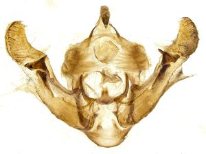


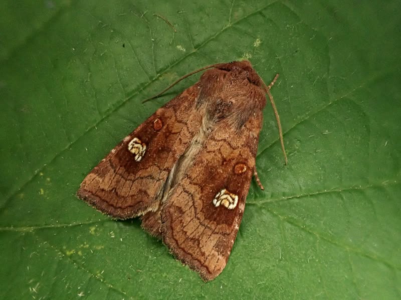
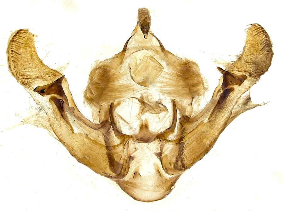


Image Gallery

Temporal Distribution Chart
Adults: (between 1906 - 2025)
Distribution Map for Amphipoea oculea
↳ from 2026+
↳ 3 from 2020 - 2025
↳ 40 from Before 2020
If the Map Layers function fails, just refresh the page and it should be OK after. Use the +- zoom on the top left, or on a tablet, use two fingers to zoom. Remember, the last layer you ticked is the one which displays the popup information - they sit on top of each other - de-select then re-select, to see the popup values.
Bedrock Geology ** indirectly affects moth distribution by influencing the type of habitat and food plants available in an area. In turn, this may affect the types of moths that can thrive, or where they can most likely be found.
NBN Atlas UK Distribution for – Amphipoea oculea
⚠️ Please wait for the map to load fully – do not click the link shown.
Note – the NBN Atlas datasets are listed in the map below and vary in their currency (uptodateness) – however,
the map does give a general indication of the moth's distribution across the UK.
Monthly Records By Year:
Amphipoea oculea
( data includes both Larvae and Adult Stages )
Monthly Counts By Year:
Amphipoea oculea
( data is based on 'Adult' stage records only )
First/Last Recorded Dates: Amphipoea oculea
Adult-only & Anything [Larvae, Pupae, Adult, Mines]
Shading shows moth presence between dates
Click the colour discs below to Select/De-select as Required
Recordings By Year: Amphipoea oculea
( All data includes both Larvae and Adult Stages )
Annual Growth Rate (AGR): Amphipoea oculea
AGR: -3.25% | Total % Change: -50%
Hectad (10kmx10km) Coverage: Amphipoea oculea
( data includes both Larvae and Adult Stages )
Flight Periods – Indicative –vs– Recorded Data
Amphipoea oculea
Amphipoea oculea
Flight Period chart – the grey hatched area above, which can cross one or more months, pictorially represents the best guess we have for this moth's flight periods [month/s]. The coloured lines represent the actual months seen in flight, from site observation records received between 2020-2026.
Records Behind the Map and Charts - Amphipoea oculea – 43 records available
Listed by Year - descending - scroll across to see all table columns
| Site Name | Tetrad | Date | Count | Stage | Recorder | Source | RecordKey |
|---|---|---|---|---|---|---|---|
| Haddon Hall | SK26I | 06/08/2025 | 1 | Adult | Orridge, Steve | vc57_irecords_extract | iBRC48244635 |
| Ladycroft Ave, Buxton | SK07S | 24/07/2024 | 1 | Adult | Orridge, Steve | vc57_irecords_extract | iBRC37656333 |
| Kirk Hallam, Ilkeston | SK44K | 16/09/2020 | 1 | Adult | Hobby, Brian | vc57_irecords_extract | iBRC41040658 |
| Coxbench (site not precise) | SK34R | 12/09/2016 | 1 | Adult | Unknown;Hanson Sale | vc57_danes_bc_data | LC000334001WPTNN |
| Repton (site not precise) | SK32B | 01/09/2013 | 1 | Adult | H.C. Hayward | vc57_danes_bc_data | LC000334001WQINL |
| Bilberry Wood, Ambergate | SK35L | 02/08/2012 | 1 | Adult | Dave Budworth;P. Patrick | vc57_danes_bc_data | LC000334001OL8GS |
| Oaks Barn Cottage, Monyash Rd, Over Haddon, Bakewell | SK26D | 09/08/2010 | 1 | Adult | D.A. Clarke | vc57_danes_bc_data | LC000334001OK4SZ |
| Repton (site not precise) | SK32B | 15/09/2009 | 1 | Adult | H.C. Hayward | vc57_danes_bc_data | LC000334001WPCQH |
| Alport Dale, nr Ladybower Resr | SK18P | 06/09/2005 | 2 | Adult | H.E. Beaumont;R.F. Botterill | vc57_danes_bc_data | LC000334001OHS7U |
| The Hollies,Station Rd,Darley Dale | SK26R | 05/09/2005 | 1 | Adult | Roddis, Simon | vc57_danes_bc_data | LC000334001OI6VM |
| The Hollies,Station Rd,Darley Dale | SK26R | 03/08/2005 | 1 | Adult | Roddis, Simon | vc57_danes_bc_data | LC000334001OHRYL |
| The Hollies,Station Rd,Darley Dale | SK26R | 08/08/2004 | 1 | Adult | Roddis, Simon | vc57_danes_bc_data | LC000334001OJ7MD |
| Church St,Holloway,Matlock | SK35I | 07/08/2004 | 3 | Adult | F. Harrison | vc57_danes_bc_data | LC000334001OHQSA |
| Whiteley's Garden Cressbrook | SK17R | 01/09/1999 | 1 | Adult | Whiteley, Derek | vc57_irecords_extract | iBRC3038607 |
| Calke Park (Betty's Pool),Ticknall | SK32R | 09/08/1997 | 1 | Adult | I. Travers-Ayre;I.M. Viles;S. Wright;T. Barnard | vc57_danes_bc_data | LC000334001WP5CC |
| Calke Park (Betty's Pool),Ticknall | SK32R | 23/07/1997 | 2 | Adult | VC57 Derbyshire Recorder | vc57_danes_bc_data | LC000334001OJ0L0 |
| Wragg's Quarry,Rowsley Moor | SK26Y | 05/09/1981 | 1 | Adult | VC57 Derbyshire Recorder | vc57_danes_bc_data | LC000334001OHYDC |
| Wragg's Quarry, Beeley Moor, Beeley | SK26Y | 05/09/1981 | 1 | Adult | B. Elliott | vc57_danes_bc_data | LC000334001WPJ4J |
| Drummond Rd, Ilkeston | SK44R | 07/08/1980 | 5 | Adult | T. Duro | vc57_danes_bc_data | LC000334001OIMY9 |
| Drummond Rd, Ilkeston | SK44R | 03/08/1980 | 8 | Adult | T. Duro | vc57_danes_bc_data | LC000334001OIMW5 |
| Drummond Rd, Ilkeston | SK44R | 31/07/1980 | 12 | Adult | T. Duro | vc57_danes_bc_data | LC000334001OIMTX |
| Drummond Rd, Ilkeston | SK44R | 29/07/1980 | 15 | Adult | T. Duro | vc57_danes_bc_data | LC000334001OIA3Y |
| Drummond Rd, Ilkeston | SK44R | 27/07/1980 | 4 | Adult | T. Duro | vc57_danes_bc_data | LC000334001OIMR8 |
| Drummond Rd, Ilkeston | SK44R | 21/07/1980 | 1 | Adult | T. Duro | vc57_danes_bc_data | LC000334001OHGY3 |
| Drummond Rd, Ilkeston | SK44R | 19/07/1980 | 2 | Adult | T. Duro | vc57_danes_bc_data | LC000334001OIMM3 |
| Newbold Ave, Chesterfield | SK37R | 20/09/1976 | 1 | Adult | VC57 Derbyshire Recorder | vc57_danes_bc_data | LC000334001OI9VO |
| Askew Grove, Repton | SK32D | 25/08/1974 | 1 | Adult | D.A. Young | vc57_danes_bc_data | LC000334001OIIU9 |
| Paulet School, Brizlincote, Burton on Trent | SK22K | 16/07/1969 | 1 | Adult | Rothamsted Staff;G. Goodall | vc57_danes_bc_data | LC000334001WOZ1R |
| Newbold Rd, Chesterfield | SK37R | 08/09/1962 | 1 | Adult | VC57 Derbyshire Recorder | vc57_danes_bc_data | LC000334001OHEDB |
| Newbold Ave, Chesterfield | SK37R | 18/09/1958 | 1 | Adult | VC57 Derbyshire Recorder | vc57_danes_bc_data | LC000334001OIFUC |
| Walton Wood, Walton, Chesterfield | SK36U | 05/09/1957 | 1 | Adult | VC57 Derbyshire Recorder | vc57_danes_bc_data | LC000334001OIFLH |
| Holymoorside | SK36J | 31/08/1957 | 1 | Adult | VC57 Derbyshire Recorder | vc57_danes_bc_data | LC000334001OHEXH |
| Newbold Ave, Chesterfield | SK37R | 23/08/1957 | 1 | Adult | VC57 Derbyshire Recorder | vc57_danes_bc_data | LC000334001OHDPR |
| Newbold Ave, Chesterfield | SK37R | 22/08/1957 | 1 | Adult | VC57 Derbyshire Recorder | vc57_danes_bc_data | LC000334001OHDPG |
| Newbold Ave, Chesterfield | SK37R | 06/09/1952 | 1 | Adult | VC57 Derbyshire Recorder | vc57_danes_bc_data | LC000334001OIDD4 |
| Newland Gardens, Newbold, Chesterfield | SK37R | 05/09/1951 | 1 | Adult | VC57 Derbyshire Recorder | vc57_danes_bc_data | LC000334001OJHND |
| Coxbench (site not precise) | SK34R | 12/09/1916 | 1 | Adult | VC57 Derbyshire Recorder | vc57_danes_bc_data | LC000334001OID7L |
| Repton (site not precise) | SK32B | 01/09/1913 | 1 | Adult | VC57 Derbyshire Recorder | vc57_danes_bc_data | LC000334001OHDEN |
| Repton (site not precise) | SK32B | 15/09/1909 | 1 | Adult | VC57 Derbyshire Recorder | vc57_danes_bc_data | LC000334001OHDDD |
| Poolsbrook, Staveley (site not precise) | SK47G | 12/08/1906 | 1 | Adult | S. Hooke | vc57_danes_bc_data | LC000334001OHD5S |
| Little Eaton (site not precise) | SK34R | 01/01/1905 | 1 | Adult | G. Pike | vc57_danes_bc_data | LC000334001WPZA1 |
| Little Eaton (site not precise) | SK34R | 01/01/1900 | 1 | Adult | VC57 Derbyshire Recorder | vc57_danes_bc_data | LC000334001OJHEW |
| Bretby area, Swadlincote (site not precise) | SK22W | 01/01/1885 | 1 | Adult | T. Gibbs | vc57_danes_bc_data | LC000334001WP37L |