 – click for General Verification Guidelines |
– click for Specific Verification Guidelines
– click for General Verification Guidelines |
– click for Specific Verification Guidelines
 – Generally Common / Widespread
Confusion Species: Piniphila bifasciana
Blue-coded] moths is not displayed/updated in this tab. However, all verified records for this moth are listed in the RECORDS tab below.

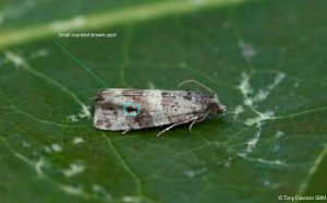


Image Gallery
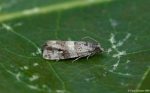
No gallery images found for this moth.
Temporal Distribution Chart
Adults: (between 1993 - 2026)
Distribution Map for Lobesia abscisana
↳ 7 from 2026+
↳ 25 from 2020 - 2025
↳ 54 from Before 2020
If the Map Layers function fails, just refresh the page and it should be OK after. Use the +- zoom on the top left, or on a tablet, use two fingers to zoom. Remember, the last layer you ticked is the one which displays the popup information - they sit on top of each other - de-select then re-select, to see the popup values.
Bedrock Geology ** indirectly affects moth distribution by influencing the type of habitat and food plants available in an area. In turn, this may affect the types of moths that can thrive, or where they can most likely be found.
NBN Atlas UK Distribution for – Lobesia abscisana
⚠️ Please wait for the map to load fully – do not click the link shown.
Note – the NBN Atlas datasets are listed in the map below and vary in their currency (uptodateness) – however,
the map does give a general indication of the moth's distribution across the UK.
Monthly Records By Year:
Lobesia abscisana
( data includes both Larvae and Adult Stages )
Monthly Counts By Year:
Lobesia abscisana
( data is based on 'Adult' stage records only )
First/Last Recorded Dates: Lobesia abscisana
Adult-only & Anything [Larvae, Pupae, Adult, Mines]
Shading shows moth presence between dates
Click the colour discs below to Select/De-select as Required
Recordings By Year: Lobesia abscisana
( All data includes both Larvae and Adult Stages )
Annual Growth Rate (AGR): Lobesia abscisana
AGR: 1.56% | Total % Change: 42.9%
Hectad (10kmx10km) Coverage: Lobesia abscisana
( data includes both Larvae and Adult Stages )
Flight Periods – Indicative –vs– Recorded Data
Lobesia abscisana
Lobesia abscisana
Flight Period chart – the grey hatched area above, which can cross one or more months, pictorially represents the best guess we have for this moth's flight periods [month/s]. The coloured lines represent the actual months seen in flight, from site observation records received between 2020-2026.
Records Behind the Map and Charts - Lobesia abscisana – 86 records available
Listed by Year - descending - scroll across to see all table columns
| Site Name | Tetrad | Date | Count | Stage | Recorder | Source | RecordKey |
|---|---|---|---|---|---|---|---|
| Carsington Hopton reedbed | SK25R | 14/07/2026 | 1 | adult | Ashton, Clive | vc57_irecords_extract | iBRC54902162 |
| DWT Wyver Lane | SK35K | 09/07/2026 | 2 | adult | Dave Evans, Dave Newcombe & Richard Taylor | vc57_irecords_extract | iBRC54735019 |
| Markham Vale South Tip , Derbyshire | SK47K | 09/07/2026 | 1 | adult | Morris, Sid | vc57_irecords_extract | iBRC54724105 |
| Markham Vale Env. Cent. Derbyshire | SK47K | 09/07/2026 | 1 | adult | Morris, Sid ( M.V. Trapping group ) | vc57_irecords_extract | iBRC54763493 |
| Belper | SK34N | 08/07/2026 | 1 | adult | Evans, Dave | vc57_irecords_extract | iBRC54607832 |
| Calke Park, Derbyshire | SK32L | 07/07/2026 | 2 | adult | Browne, Sean | vc57_irecords_extract | iBRC54638082 |
| NT Kedleston Hall | SK34A | 25/06/2026 | 2 | adult | Evans, Dave & Clive Ashton | vc57_irecords_extract | iBRC54102887 |
| Findern, Derbyshire | SK33A | 22/08/2025 | 1 | Adult | Hallam, Brian | vc57_irecords_extract | iBRC44715972 |
| Shirland - Hallfieldgate Lane | SK35Z | 13/08/2025 | 1 | Adult | Mahadevan, Nikki | vc57_irecords_extract | iBRC44480106 |
| Belper, Derbyshire | SK34N | 30/07/2025 | 1 | Adult | Newcombe, Dave | vc57_irecords_extract | iBRC44352066 |
| Belper | SK34N | 23/07/2025 | 1 | Adult | Evans, Dave | vc57_irecords_extract | iBRC43782528 |
| Belper, Derbyshire | SK34N | 17/07/2025 | 1 | Adult | Newcombe, Dave | vc57_irecords_extract | iBRC44236056 |
| Ladycroft Ave, Buxton | SK07S | 08/07/2025 | 1 | Adult | Orridge, Steve | vc57_irecords_extract | iBRC43202703 |
| upper cromford garden | SK25Y | 01/07/2025 | 1 | Adult | Ashton, Clive | vc57_irecords_extract | iBRC42924229 |
| Langley Mill | SK44N | 30/06/2025 | 1 | Adult | Benniston, Lucy | vc57_irecords_extract | iBRC42807946 |
| Shirland - Hallfieldgate Lane | SK35Z | 29/06/2025 | 2 | Adult | Mahadevan, Nikki | vc57_irecords_extract | iBRC42808570 |
| Glossop, Gnat Hole Rough Fields | SK09L | 24/06/2025 | 2 | Adult | Heintzen, Christian | vc57_irecords_extract | iBRC43979653 |
| Belper | SK34U | 12/08/2024 | 1 | Adult | Evans, Dave | vc57_irecords_extract | iBRC37871277 |
| Norton Lees, Sheffield (VC) | SK38L | 05/08/2024 | 1 | Adult | Mella, Pete | vc57_irecords_extract | iBRC38368876 |
| Belper | SK34U | 28/07/2024 | 1 | Adult | Evans, Dave | vc57_irecords_extract | iBRC37494231 |
| High Leas Farm, Riber | SK35D | 28/07/2024 | 1 | Adult | Thorpe, Steve | vc57_irecords_extract | iBRC40044984 |
| Haddon Hall | SK26I | 10/08/2023 | 1 | Adult | S.A.Orridge, L.Y.Orridge, M Dale | vc57_irecords_extract | iBRC35077420 |
| Mickleover garden | SK33C | 25/06/2023 | 1 | Adult | Maughan, Christine | vc57_irecords_extract | iBRC35618715 |
| EA depot | SK43G | 10/08/2022 | 1 | Adult | Collins, Stuart | vc57_irecords_extract | iBRC28766803 |
| Allestree, Derby | SK33P | 20/07/2022 | 1 | Adult | Plant, Stephen | vc57_irecords_extract | iBRC48233959 |
| Staveley Derbyshire | SK47H | 14/07/2022 | 1 | Adult | Morris, Sid | vc57_irecords_extract | iBRC26903918 |
| Staveley Derbyshire | SK47H | 07/07/2022 | 1 | Adult | Morris, Sid | vc57_irecords_extract | iBRC26768883 |
| Belper | SK34U | 23/07/2021 | 1 | Adult | Evans, Dave | vc57_irecords_extract | iBRC35323067 |
| Not given | SK22F | 08/07/2021 | 1 | Adult | Williams, Michael | vc57_irecords_extract | iBRC21019992 |
| Drakelow, Derbys. | SK22F | 08/07/2021 | 1 | Adult | Williams, Michael | vc57_irecords_extract | iBRC38545835 |
| Hathersage | SK28F | 08/09/2020 | 1 | Adult | Kydd, Alan | vc57_irecords_extract | iBRC39036581 |
| Main Street, Kings Newton | SK32Y | 12/07/2020 | 1 | Adult | Soar, Will | vc57_irecords_extract | iBRC34060414 |
| Rosliston (National Forest Centre), Swadlincote | SK21N | 22/07/2016 | 1 | Adult | BUDWORTH, Mr D., WARD, Mr N.J., PATRICK, Mr P., CO | vc57_danes_bc_data | LC000334001COV5J |
| Main Street, Kings Newton | SK32Y | 17/07/2016 | 1 | Adult | Soar, Will | vc57_irecords_extract | iBRC34060415 |
| Main Street, Kings Newton | SK32Y | 16/07/2016 | 1 | Adult | Soar, Will | vc57_irecords_extract | iBRC34060416 |
| Shirland-Hallfieldgate Lane | SK35Z | 16/08/2015 | 1 | Adult | Mahadevan, Nikki | vc57_irecords_extract | iBRC35070526 |
| Jim Mart Nature Reserve | SK36S | 03/08/2014 | 1 | Adult | Mahadevan, Nikki | vc57_irecords_extract | iBRC34906874 |
| Burnaston (Toyota Plant NR), Derby | SK23V | 20/07/2013 | 1 | Adult | Dave Budworth;B.G. Sewell | vc57_danes_bc_data | LC000334001CP93U |
| Nether Hall Wood, Hartshorne, Swadlincote | SK32A | 19/07/2013 | 1 | Adult | Dave Budworth | vc57_danes_bc_data | LC000334001COYO7 |
| Backgarden Marehay | SK34Z | 05/08/2012 | 1 | Adult | Thorpe, Steve | vc57_irecords_extract | iBRC33511318 |
| Bamford St,Ripley | SK34Z | 05/08/2012 | 1 | Adult | Thorpe, Steve | vc57_danes_bc_data | LC000334001COYCI |
| Duffield Rd, Allestree, Derby | SK34K | 26/07/2012 | 1 | Adult | P. Smith | vc57_danes_bc_data | LC000334001CP883 |
| George St,Belper | SK34N | 01/06/2012 | 2 | Adult | K.R. Huston | vc57_danes_bc_data | LC000334001CP7RF |
| Crays Hill Park, Leabrooks, Alfreton | SK45B | 22/09/2010 | 1 | Adult | K.R. Huston | vc57_danes_bc_data | LC000334001COZGT |
| Rose Av,Clowne | SK57D | 13/08/2010 | 1 | Adult | D. Hursthouse | vc57_danes_bc_data | LC000334001CP6FG |
| Rose Av,Clowne | SK57D | 10/08/2010 | 1 | Adult | D. Hursthouse | vc57_danes_bc_data | LC000334001COXFD |
| Rose Av,Clowne | SK57D | 09/08/2010 | 1 | Adult | D. Hursthouse | vc57_danes_bc_data | LC000334001CP6EK |
| Rose Av,Clowne | SK57D | 03/08/2010 | 2 | Adult | D. Hursthouse | vc57_danes_bc_data | LC000334001CP6AN |
| Dovedale | SK15K | 30/07/2010 | 1 | Adult | D. Grundy | vc57_danes_bc_data | LC000334001CP68B |
| Rose Av,Clowne | SK57D | 22/07/2010 | 1 | Adult | D. Hursthouse | vc57_danes_bc_data | LC000334001CP082 |
| Rose Av,Clowne | SK57D | 20/07/2010 | 3 | Adult | D. Hursthouse | vc57_danes_bc_data | LC000334001COTEN |
| Midway Rd,Midway,Swadlincote | SK32A | 09/07/2010 | 1 | Adult | M.J. Williams | vc57_danes_bc_data | LC000334001CP5V5 |
| Rose Av,Clowne | SK57D | 08/07/2010 | 1 | Adult | D. Hursthouse | vc57_danes_bc_data | LC000334001COTBK |
| Main Street, Kings Newton | SK32Y | 07/07/2010 | 1 | Adult | Soar, Will | vc57_irecords_extract | iBRC34678582 |
| The Hollies,Holly St,Stapenhill,Burton on Trent | SK22K | 21/05/2010 | 1 | Adult | P. Patrick | vc57_danes_bc_data | LC000334001COT1W |
| Midway, Derbys. | SK32A | 25/07/2009 | 1 | Adult | Williams, Michael | vc57_irecords_extract | iBRC41991091 |
| Midway Rd,Midway,Swadlincote | SK32A | 25/07/2009 | 1 | Adult | M.J. Williams | vc57_danes_bc_data | LC000334001COWUB |
| Drakelow NR (Minton's Lagoon), Burton on Trent | SK22F | 24/07/2009 | 1 | Adult | M.J. Williams | vc57_danes_bc_data | LC000334001COSUR |
| Midway, Derbys. | SK32A | 10/07/2009 | 1 | Adult | Williams, Michael | vc57_irecords_extract | iBRC41990999 |
| Midway Rd,Midway,Swadlincote | SK32A | 10/07/2009 | 1 | Adult | M.J. Williams | vc57_danes_bc_data | LC000334001COSU7 |
| Main Street, Kings Newton | SK32Y | 02/08/2008 | 1 | Adult | Soar, Will | vc57_irecords_extract | iBRC34678581 |
| Midway Rd,Midway,Swadlincote | SK32A | 26/07/2008 | 1 | Adult | M.J. Williams | vc57_danes_bc_data | LC000334001CP4G2 |
| Main Street, Kings Newton | SK32Y | 19/07/2008 | 1 | Adult | Soar, Will | vc57_irecords_extract | iBRC34678580 |
| Midway Rd,Midway,Swadlincote | SK32A | 18/07/2008 | 1 | Adult | M.J. Williams | vc57_danes_bc_data | LC000334001CP4CY |
| Rosliston (National Forest Centre), Swadlincote | SK21N | 27/07/2007 | 1 | Adult | Dave Budworth;B.G. Sewell | vc57_danes_bc_data | LC000334001CP3ZN |
| Main Street, Kings Newton | SK32Y | 04/09/2006 | 1 | Adult | Soar, Will | vc57_irecords_extract | iBRC34678579 |
| Main St,Kings Newton,Melbourne | SK32Y | 04/09/2006 | 1 | Adult | Soar, Will | vc57_danes_bc_data | LC000334001CP3LK |
| Melbourne, Derbyshire | SK32X | 24/08/2006 | 2 | Adult | Davison, Tony | vc57_irecords_extract | iBRC33533920 |
| Spinney Hill,Melbourne | SK32X | 24/08/2006 | 2 | Adult | Davison, Tony | vc57_danes_bc_data | LC000334001CP3J7 |
| Melbourne, Derbyshire | SK32X | 28/07/2006 | 1 | Adult | Davison, Tony | vc57_irecords_extract | iBRC33529635 |
| Spinney Hill,Melbourne | SK32X | 28/07/2006 | 1 | Adult | Davison, Tony | vc57_danes_bc_data | LC000334001COW4Y |
| Melbourne, Derbyshire | SK32X | 21/07/2006 | 1 | Adult | Davison, Tony | vc57_irecords_extract | iBRC33529477 |
| Spinney Hill,Melbourne | SK32X | 21/07/2006 | 1 | Adult | Davison, Tony | vc57_danes_bc_data | LC000334001CP3B3 |
| Spinney Hill,Melbourne | SK32X | 05/09/2005 | 1 | Adult | Davison, Tony | vc57_danes_bc_data | LC000334001CP2WH |
| Main Street, Kings Newton | SK32Y | 29/07/2005 | 1 | Adult | Soar, Will | vc57_irecords_extract | iBRC34678578 |
| Main St,Kings Newton,Melbourne | SK32Y | 29/07/2005 | 1 | Adult | Soar, Will | vc57_danes_bc_data | LC000334001CORM0 |
| Main Street, Kings Newton | SK32Y | 13/07/2005 | 1 | Adult | Soar, Will | vc57_irecords_extract | iBRC34678577 |
| Main St,Kings Newton,Melbourne | SK32Y | 13/07/2005 | 1 | Adult | Soar, Will | vc57_danes_bc_data | LC000334001CP2PI |
| Rolls Royce site (railway track), Derby | SK33R | 16/05/2005 | 1 | Adult | Dave Budworth | vc57_danes_bc_data | LC000334001COVRX |
| Spinney Hill,Melbourne | SK32X | 01/08/2004 | 1 | Adult | Davison, Tony | vc57_danes_bc_data | LC000334001CORDZ |
| Main Street, Kings Newton | SK32Y | 23/07/2004 | 1 | Adult | Soar, Will | vc57_irecords_extract | iBRC34678576 |
| Edgecote Drive,Newhall,Swadlincote | SK22V | 21/07/2004 | 2 | Adult | Topliss, Neil | vc57_danes_bc_data | LC000334001CP226 |
| Spinney Hill,Melbourne | SK32X | 15/07/2004 | 1 | Adult | Davison, Tony | vc57_danes_bc_data | LC000334001COVMZ |
| Moss Valley (Bridle Stile Meadow) | SK48F | 01/08/2003 | 1 | Adult | H.E. Beaumont;R.F. Botterill | vc57_danes_bc_data | LC000334001COS50 |
| Acton Rd Ind Est, Long Eaton | SK43W | 19/07/1995 | 1 | Adult | VC57 Derbyshire Recorder | vc57_danes_bc_data | LC000334001CP175 |
| Deerlands Rd, Ashgate, Chesterfield | SK37K | 04/07/1993 | 1 | Adult | VC57 Derbyshire Recorder | vc57_danes_bc_data | LC000334001CP116 |