
 – click for Adult Macro Verification Guidelines
 – Significant Record / Rare / Vagrant
 – Day-flying
 – easy to identify, generally distinctive and unlikely to be confused with other species.
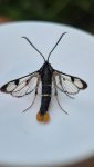
The most distinctive feature is the bright orange tail fan, which both sexes can show with variable amounts of black. The literature states that the tail fan is usually brighter in females and darker brown in males. Some individuals have been recorded with all black tail fans with slight orange margins. Both sexes show two narrow yellow bands across the abdomen.
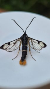
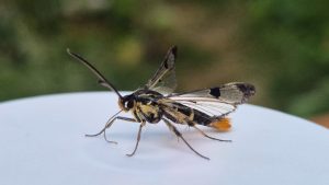
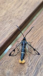
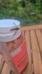
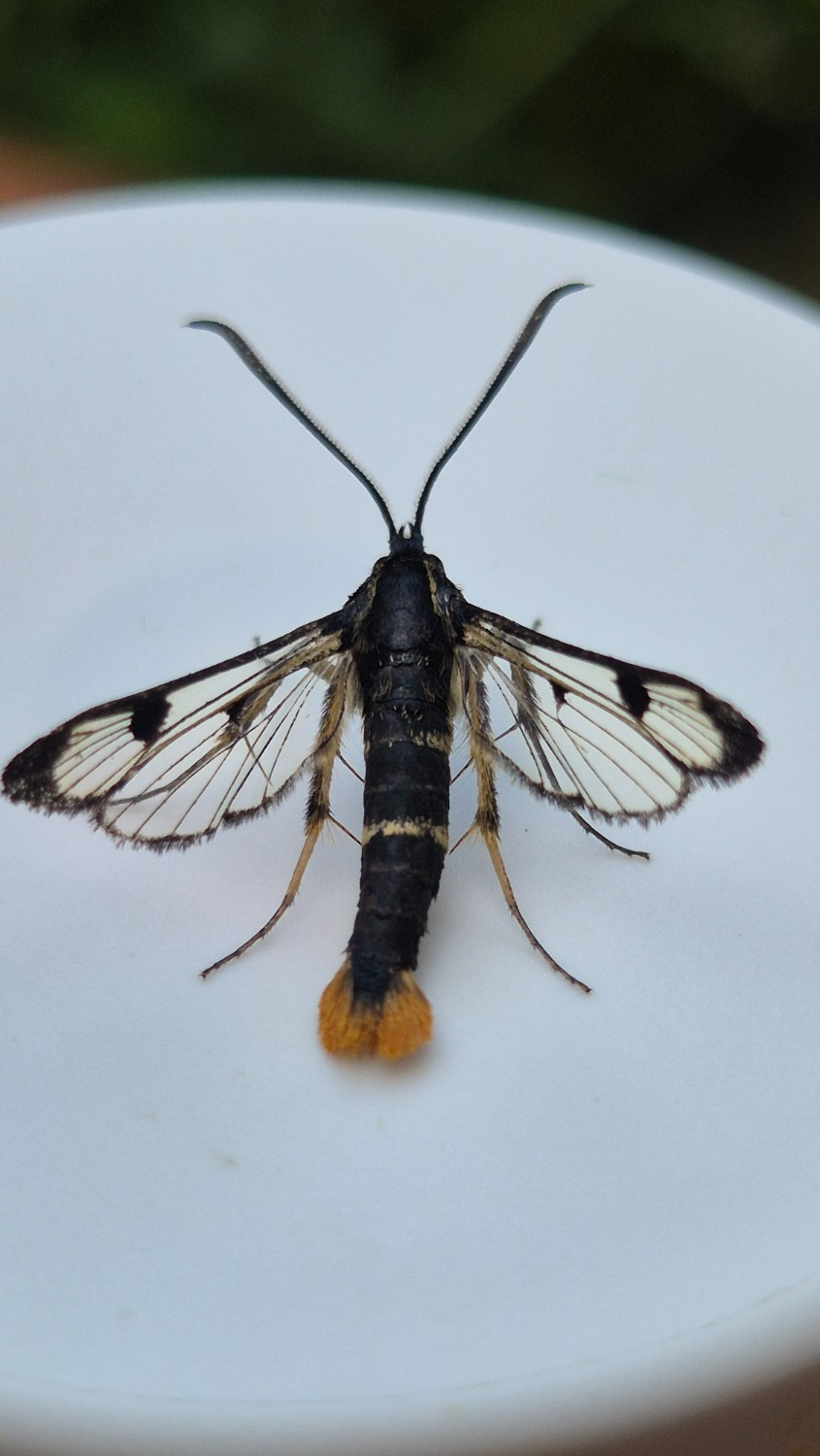
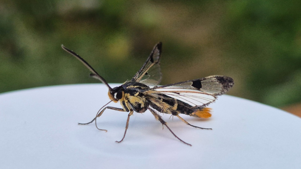
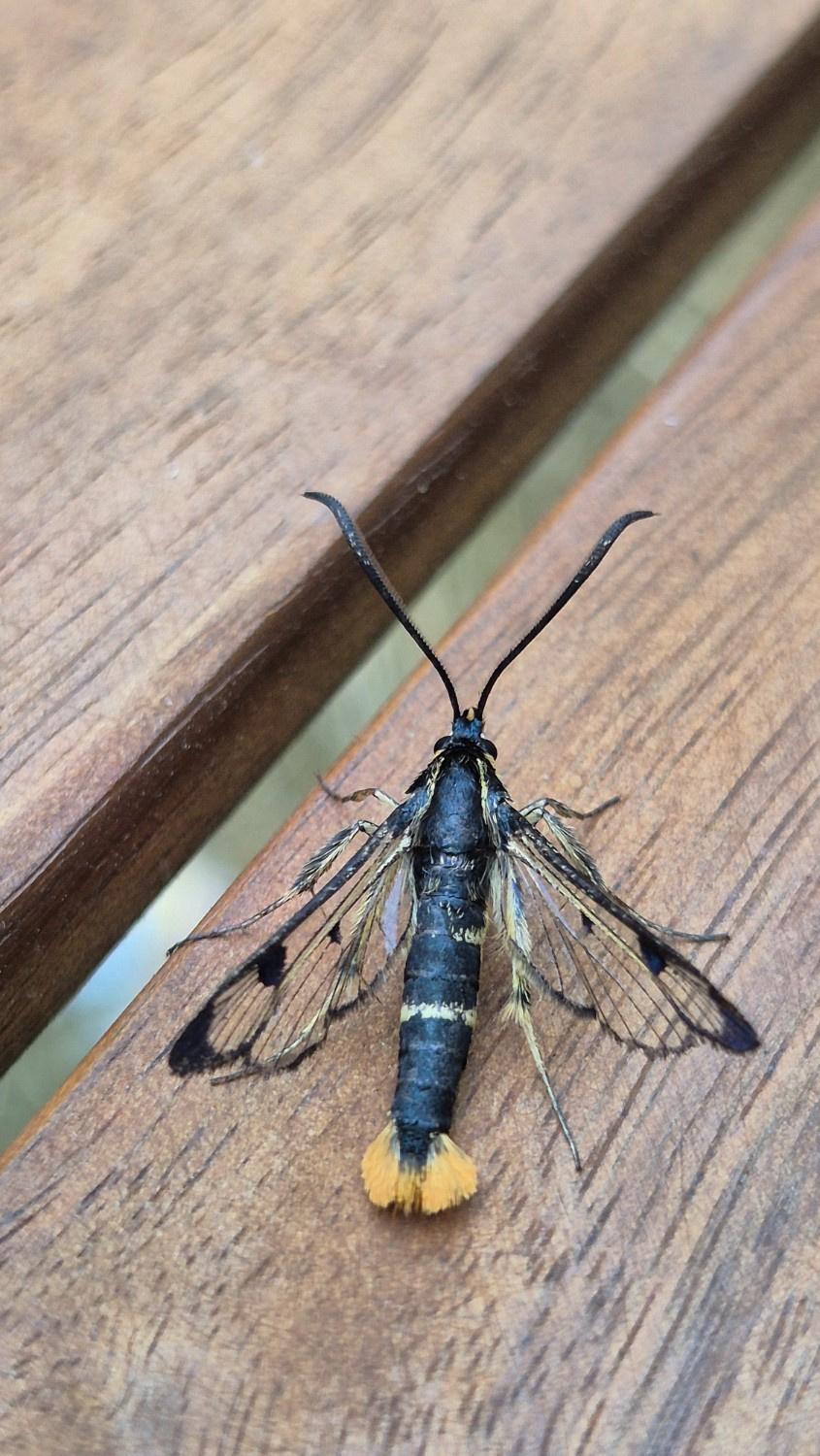
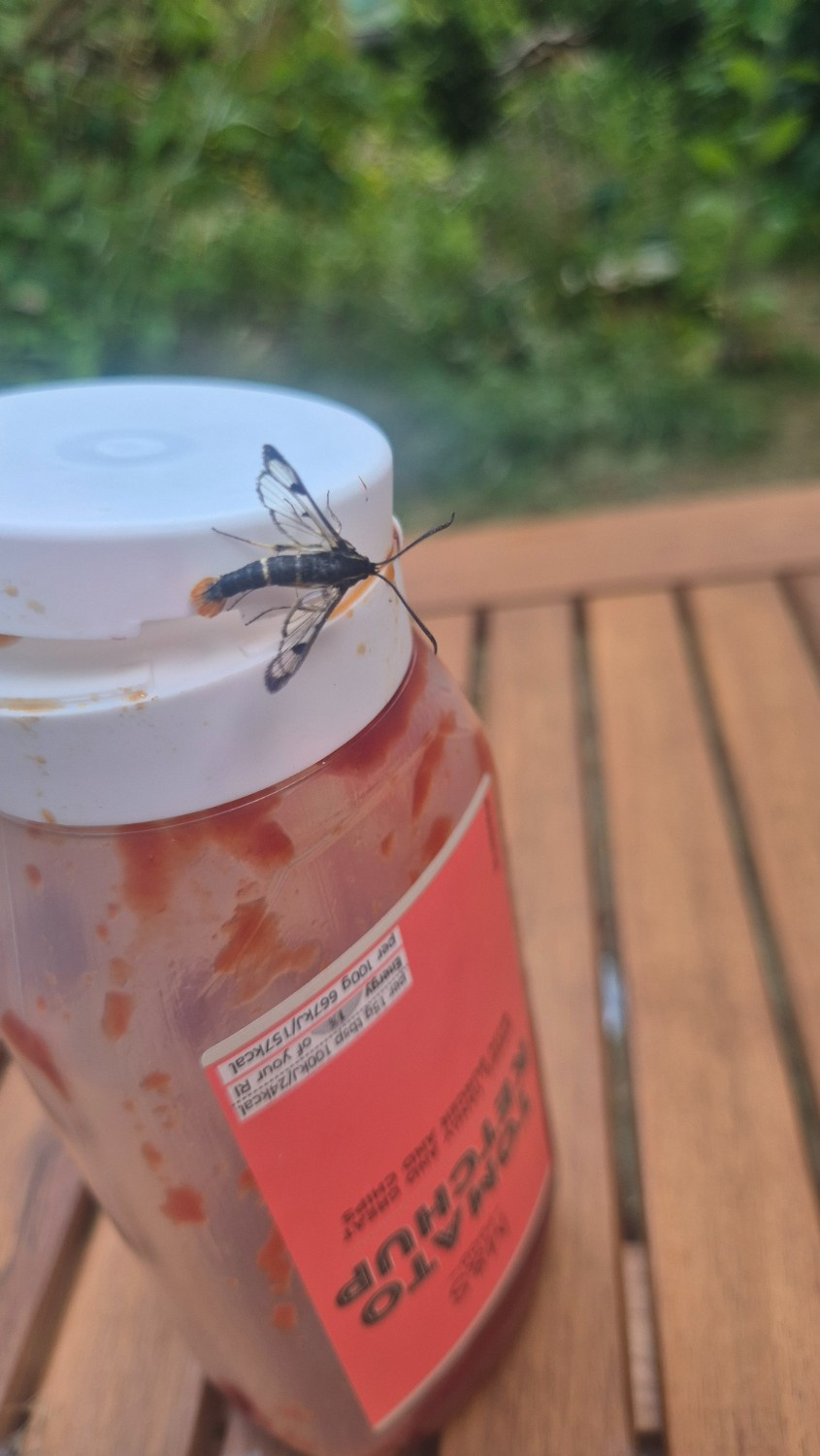
Image Gallery
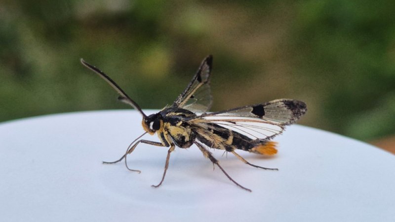
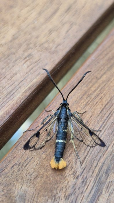
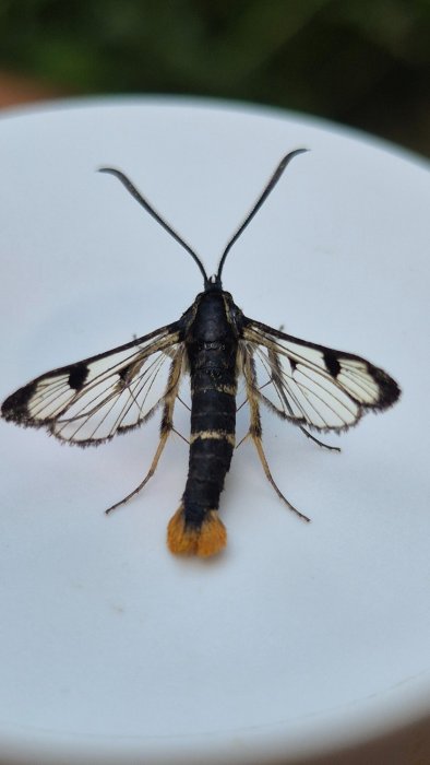
Temporal Distribution Chart
Adults: (between 2026 - 2026)
Changes in First and Last Recorded Activity Dates Over Time
Distribution Map for Synanthedon scoliaeformis
↳ 1 from 2026+
↳ from 2020 - 2025
↳ from Before 2020
If the Map Layers function fails, just refresh the page and it should be OK after. Use the +- zoom on the top left, or on a tablet, use two fingers to zoom. Remember, the last layer you ticked is the one which displays the popup information - they sit on top of each other - de-select then re-select, to see the popup values.
Bedrock Geology ** indirectly affects moth distribution by influencing the type of habitat and food plants available in an area. In turn, this may affect the types of moths that can thrive, or where they can most likely be found.
NBN Atlas UK Distribution for – Synanthedon scoliaeformis
⚠️ Please wait for the map to load fully – do not click the link shown.
Note – the NBN Atlas datasets are listed in the map below and vary in their currency (uptodateness) – however,
the map does give a general indication of the moth's distribution across the UK.
Monthly Records By Year:
Synanthedon scoliaeformis
( data includes both Larvae and Adult Stages )
Monthly Counts By Year:
Synanthedon scoliaeformis
( data is based on 'Adult' stage records only )
First/Last Recorded Dates: Synanthedon scoliaeformis
Adult-only & Anything [Larvae, Pupae, Adult, Mines]
Shading shows moth presence between dates
Click the colour discs below to Select/De-select as Required
Recordings By Year: Synanthedon scoliaeformis
( All data includes both Larvae and Adult Stages )
Annual Growth Rate (AGR): Synanthedon scoliaeformis
AGR: 0% | Total % Change: 0%
Synanthedon scoliaeformis
Insufficient records/data for an AGR analysis
Hectad (10kmx10km) Coverage: Synanthedon scoliaeformis
( data includes both Larvae and Adult Stages )
Flight Periods – Indicative –vs– Recorded Data
Synanthedon scoliaeformis
Synanthedon scoliaeformis
Flight Period chart – the grey hatched area above, which can cross one or more months, pictorially represents the best guess we have for this moth's flight periods [month/s]. The coloured lines represent the actual months seen in flight, from site observation records received between 2020-2026.
Records Behind the Map and Charts - Synanthedon scoliaeformis – 1 records available
Listed by Year - descending - scroll across to see all table columns
| Site Name | Tetrad | Date | Count | Stage | Recorder | Source | RecordKey |
|---|---|---|---|---|---|---|---|
| Old Glossop | SK09M | 26/06/2026 | 1 | adult | Winter, Stuart | vc57_irecords_extract | iBRC54128006 |